Igbo-Ukwu night lights from space
Night Light of Igbo-Ukwu (Anambra) from space (Nigeria) Src. Average luminocity for 10x10km area is 2.3843% and for 50x50km: 3.4057%.
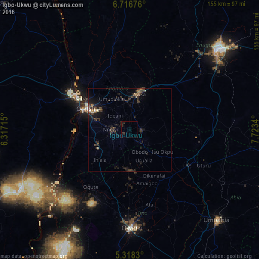
Analysis of Igbo-Ukwu night lights 2016
Square area 10x10 km:
 0%
0%90-99
0%80-89
0%70-79
0%60-69
0%50-59
0%40-49
0%30-39
3.72%20-29
3.31%10-19
0%0-9
92.98%Square area 50x50 km:
0.04%90-99
0.31%80-89
0.2%70-79
0.14%60-69
0.46%50-59
0.55%40-49
0.67%30-39
1.81%20-29
1.78%10-19
2.61%0-9
91.44%Clear (daylight) street map image can be seen on geolist.org.
Map coordinates:
6° 43' 0.3" North, 6° 19' 1.7" East
6° 1' 4.7" North, 7° 1' 13" East
5° 19' 5.9" North, 7° 43' 24.2" East
Some cities around Igbo-Ukwu sort by population:
• Nnewi
11.4 km =7.1 mi,  270°
270°
• Awka
22.4 km =13.9 mi,  14°
14°
• Agulu
10.2 km =6.3 mi,  26°
26°
• Ozubulu
19.7 km =12.2 mi,  250°
250°
• Enugu-Ukwu
17.1 km =10.6 mi,  354°
354°
• Uga
11.2 km =7 mi,  144°
144°
• Uruobo-Okija
23.6 km =14.7 mi,  236°
236°
• Orlu
24.8 km =15.4 mi,  176°
176°
2338640 (p: 75,224)
Sources (retrieved 2019-11-25):
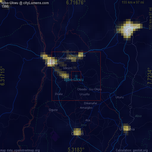
» NASA, Earths city lights 1995
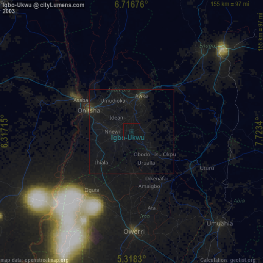
» NASA city lights 2003
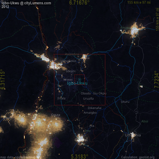
» Earth at Night: Flat Maps 2012, 2016