Orlu night lights from space
Night Light of Orlu (Imo) from space (Nigeria) Src. Average luminocity for 10x10km area is 5.6157% and for 50x50km: 1.5347%.
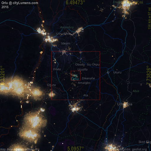
Analysis of Orlu night lights 2016
Square area 10x10 km:
100  0%
0%
90-99 0%
80-89 0%
70-79 0%
60-69 0%
50-59 0%
40-49 0.83%
30-39 7.23%
20-29 6.82%
10-19 3.1%
0-9 82.02%
0%90-99
0%80-89
0%70-79
0%60-69
0%50-59
0%40-49
0.83%30-39
7.23%20-29
6.82%10-19
3.1%0-9
82.02%Square area 50x50 km:
100 0.03%
90-99 0.05%
80-89 0.13%
70-79 0.09%
60-69 0.06%
50-59 0.21%
40-49 0.21%
30-39 1%
20-29 1.24%
10-19 1.05%
0-9 95.93%
0.03%90-99
0.05%80-89
0.13%70-79
0.09%60-69
0.06%50-59
0.21%40-49
0.21%30-39
1%20-29
1.24%10-19
1.05%0-9
95.93%Clear (daylight) street map image can be seen on geolist.org.
Map coordinates:
6° 29' 41" North, 6° 19' 55.2" East
5° 47' 44.3" North, 7° 2' 6.5" East
5° 5' 44.5" North, 7° 44' 17.7" East
Some cities around Orlu sort by population:
• Ihiala
20.5 km =12.7 mi,  288°
288°
• Igbo-Ukwu
24.8 km =15.4 mi,  356°
356°
• Uga
16.3 km =10.1 mi,  17°
17°
• Nkwerre
8.6 km =5.3 mi,  118°
118°
• Oguta
26.7 km =16.6 mi,  249°
249°
• Uruobo-Okija
24.2 km =15 mi,  298°
298°
• Orodo
19.9 km =12.4 mi,  180°
180°
• Iho
24.8 km =15.4 mi,  163°
163°
2325725 (p: 9,351)
Sources (retrieved 2019-11-25):
» Earth at Night: Flat Maps 2012, 2016