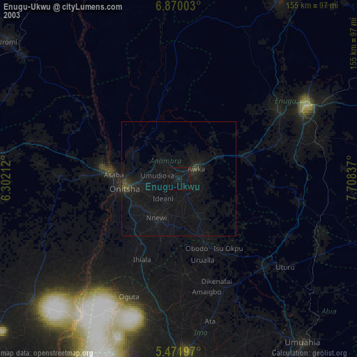
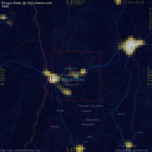
Enugu-Ukwu night lights from space
Night Light of Enugu-Ukwu (Anambra) from space (Nigeria) Src. Average luminocity for 10x10km area is 7.3099% and for 50x50km: 3.4948%.
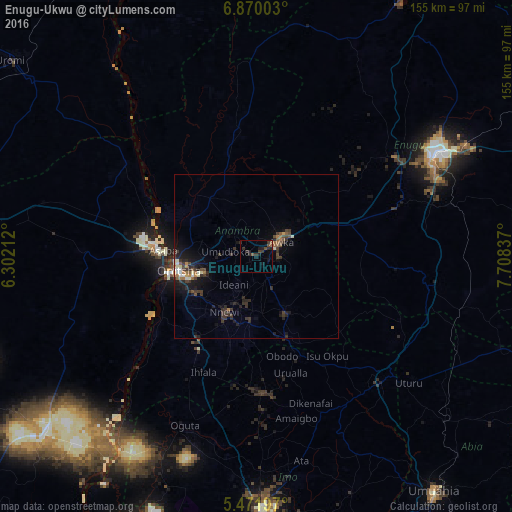
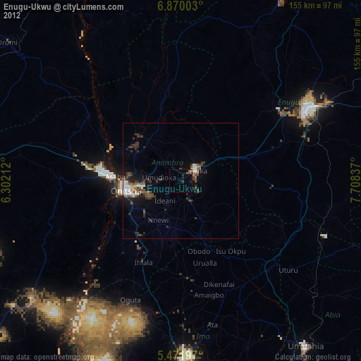
Analysis of Enugu-Ukwu night lights 2016
Square area 10x10 km:
 0%
0%90-99
0%80-89
0%70-79
0%60-69
0.62%50-59
2.07%40-49
2.07%30-39
3.51%20-29
6.2%10-19
3.93%0-9
81.61%Square area 50x50 km:
0.07%90-99
0.45%80-89
0.22%70-79
0.15%60-69
0.52%50-59
0.56%40-49
0.61%30-39
1.66%20-29
1.41%10-19
2.6%0-9
91.75%Clear (daylight) street map image can be seen on geolist.org.
Map coordinates:
6° 52' 12.1" North, 6° 18' 7.6" East
6° 10' 17.3" North, 7° 0' 18.9" East
5° 28' 19.1" North, 7° 42' 30.1" East
Some cities around Enugu-Ukwu sort by population:
• Onitsha
24.4 km =15.2 mi,  264°
264°
• Nnewi
19.5 km =12.1 mi,  209°
209°
• Awka
8.7 km =5.4 mi,  58°
58°
• Nkpor
19.5 km =12.1 mi, 263°
• Agulu
10 km =6.2 mi,  142°
142°
• Igbo-Ukwu
17.1 km =10.6 mi,  174°
174°
• Ozubulu
29.1 km =18.1 mi,  215°
215°
• Uga
27.5 km =17.1 mi,  162°
162°
2343270 (p: 68,785)
Sources (retrieved 2019-11-25):
» NASA, Earths city lights 1995
» NASA city lights 2003
» Earth at Night: Flat Maps 2012, 2016