Abuja night lights from space
Night Light of Abuja (FCT) from space (Nigeria) Src. Average luminocity for 10x10km area is 93.2641% and for 50x50km: 24.4153%.
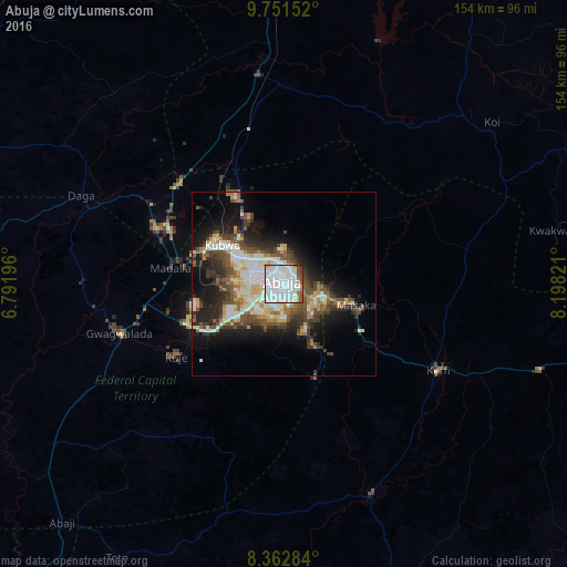
Analysis of Abuja night lights 2016
Square area 10x10 km:
 51.73%
90-99
32.25%80-89
3.25%70-79
0.87%60-69
4.55%50-59
4.33%40-49
2.81%30-39
0%20-29
0.22%10-19
0%0-9
0%Square area 50x50 km:
3.9%90-99
6.5%80-89
2.47%70-79
2.28%60-69
2.37%50-59
3.6%40-49
4.54%30-39
3.97%20-29
5.53%10-19
10.33%0-9
54.51%Clear (daylight) street map image can be seen on geolist.org.
Map coordinates:
9° 45' 5.5" North, 6° 47' 31.1" East
9° 3' 28.3" North, 7° 29' 42.3" East
8° 21' 46.2" North, 8° 11' 53.6" East
Some cities around Abuja sort by population:
• Suleja
37.2 km =23.1 mi,  291°
291°
• Kuje
35.4 km =22 mi,  235°
235°
• Keffi
47.8 km =29.7 mi,  119°
119°
• Nasarawa
62.3 km =38.7 mi,  157°
157°
• Akwanga
101.4 km =63 mi,  99°
99°
• Madala
31.4 km =19.5 mi,  279°
279°
• Buga
65.3 km =40.6 mi,  194°
194°
• Kwali
55.8 km =34.7 mi,  249°
249°
2352778 (p: 590,400)
Sources (retrieved 2019-11-25):
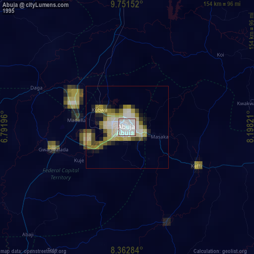
» NASA, Earths city lights 1995
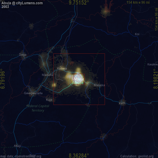
» NASA city lights 2003
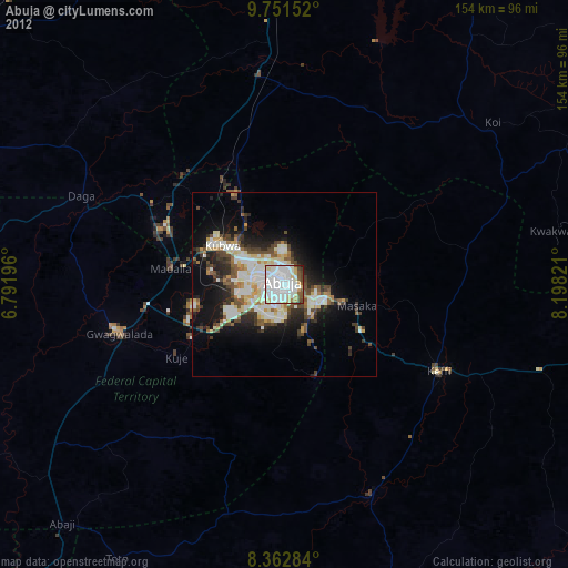
» Earth at Night: Flat Maps 2012, 2016