Kwali night lights from space
Night Light of Kwali (FCT) from space (Nigeria) Src. Average luminocity for 10x10km area is 0.0541% and for 50x50km: 0.9528%.
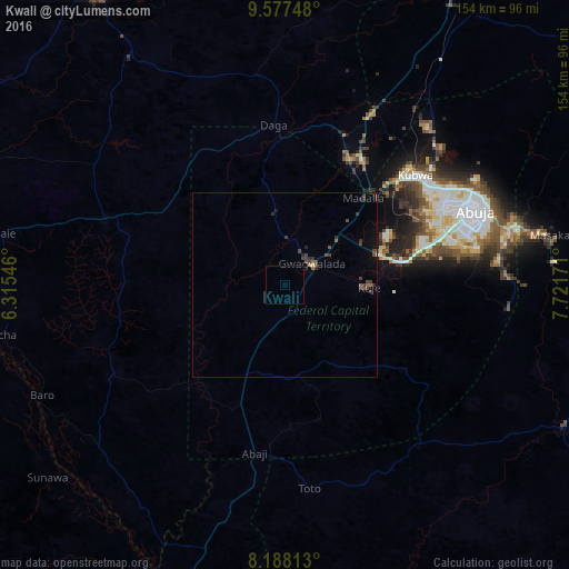
Analysis of Kwali night lights 2016
Square area 10x10 km:
100  0%
0%
90-99 0%
80-89 0%
70-79 0%
60-69 0%
50-59 0%
40-49 0%
30-39 0%
20-29 0%
10-19 0%
0-9 100%
0%90-99
0%80-89
0%70-79
0%60-69
0%50-59
0%40-49
0%30-39
0%20-29
0%10-19
0%0-9
100%Square area 50x50 km:
100 0.01%
90-99 0.01%
80-89 0.03%
70-79 0.03%
60-69 0.04%
50-59 0.26%
40-49 0.37%
30-39 0.48%
20-29 0.34%
10-19 0.52%
0-9 97.9%
0.01%90-99
0.01%80-89
0.03%70-79
0.03%60-69
0.04%50-59
0.26%40-49
0.37%30-39
0.48%20-29
0.34%10-19
0.52%0-9
97.9%Clear (daylight) street map image can be seen on geolist.org.
Map coordinates:
9° 34' 38.9" North, 6° 18' 55.7" East
8° 53' 0.5" North, 7° 1' 6.9" East
8° 11' 17.3" North, 7° 43' 18.2" East
Some cities around Kwali sort by population:
• Abuja
55.8 km =34.7 mi,  69°
69°
• Suleja
37.5 km =23.3 mi,  28°
28°
• Kuje
23 km =14.3 mi,  91°
91°
• Baro
72.4 km =45 mi,  245°
245°
• Lapai
52.3 km =32.5 mi,  289°
289°
• Madala
32.6 km =20.3 mi,  41°
41°
• Agaie
78.2 km =48.6 mi,  280°
280°
• Buga
56.3 km =35 mi,  140°
140°
2332865 (p: 6,229)
Sources (retrieved 2019-11-25):
» Earth at Night: Flat Maps 2012, 2016