Swakopmund night lights from space
Night Light of Swakopmund (Erongo) from space (Namibia) Src. Average luminocity for 10x10km area is 26.3135% and for 50x50km: 1.6138%.

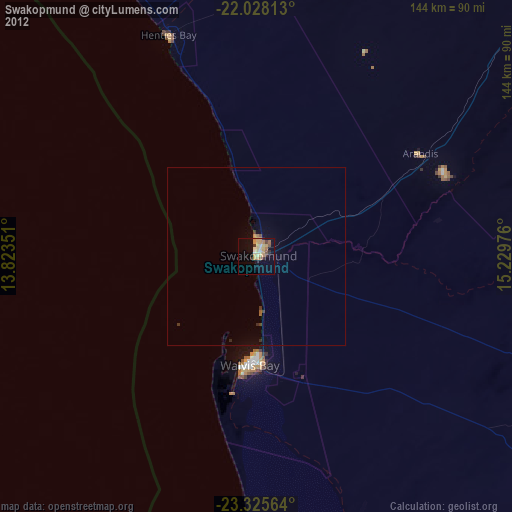
Analysis of Swakopmund night lights 2016
Square area 10x10 km:
 3.77%
3.77%90-99
4.37%80-89
1.39%70-79
6.35%60-69
5.56%50-59
1.98%40-49
3.17%30-39
1.59%20-29
4.17%10-19
19.64%0-9
48.02%Square area 50x50 km:
0.15%90-99
0.17%80-89
0.06%70-79
0.31%60-69
0.29%50-59
0.15%40-49
0.28%30-39
0.21%20-29
0.3%10-19
1.31%0-9
96.78%Clear (daylight) street map image can be seen on geolist.org.
Map coordinates:
22° 1' 41.3" South, 13° 49' 24.6" East
22° 40' 42.3" South, 14° 31' 35.9" East
23° 19' 32.3" South, 15° 13' 47.1" East
Some cities around Swakopmund sort by population:
• Walvis Bay
31.1 km =19.3 mi,  184°
184°
• Katutura
260.7 km =162 mi,  86°
86°
• Okahandja
257.7 km =160.1 mi,  72°
72°
• Khorixas
261 km =162.2 mi,  10°
10°
• Omaruru
200.4 km =124.5 mi,  46°
46°
• Usakos
133.7 km =83.1 mi,  55°
55°
• Otjimbingwe
169 km =105 mi,  77°
77°
• Karibib
157.9 km =98.1 mi, 58°
3352844 (p: 25,047)
Sources (retrieved 2019-11-25):
» Earth at Night: Flat Maps 2012, 2016