Kuantan night lights from space
Night Light of Kuantan (Pahang) from space (Malaysia) Src. Average luminocity for 10x10km area is 74.9156% and for 50x50km: 15.1269%.
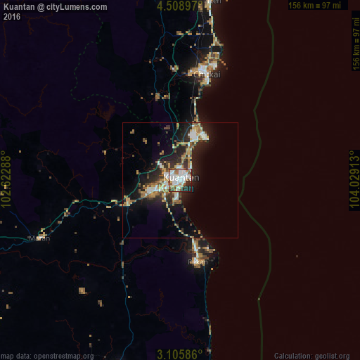

Analysis of Kuantan night lights 2016
Square area 10x10 km:
 24.68%
90-99
26.19%80-89
4.98%70-79
7.36%60-69
5.63%50-59
8.01%40-49
4.55%30-39
6.28%20-29
8.44%10-19
3.9%0-9
0%Square area 50x50 km:
2.2%90-99
2.57%80-89
1.32%70-79
2.51%60-69
2.14%50-59
1.96%40-49
1.76%30-39
2%20-29
5.22%10-19
9.94%0-9
68.37%Clear (daylight) street map image can be seen on geolist.org.
Map coordinates:
4° 30' 32.3" North, 102° 37' 22.4" East
3° 48' 27.7" North, 103° 19' 33.6" East
3° 6' 21.1" North, 104° 1' 44.9" East
Some cities around Kuantan sort by population:
• Cukai
50.2 km =31.2 mi,  11°
11°
• Temerluh
108.3 km =67.3 mi,  248°
248°
• Mentekab
114.2 km =71 mi, 251°
• Jerantut
107.8 km =67 mi,  277°
277°
• Pekan
37 km =23 mi,  167°
167°
• Kertih
79.7 km =49.5 mi, 9°
• Paka
93.1 km =57.8 mi, 7°
• Kuala Lipis
147.9 km =91.9 mi,  286°
286°
1735227 (p: 366,229)
Sources (retrieved 2019-11-25):
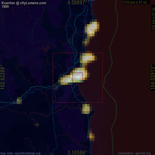
» NASA, Earths city lights 1995
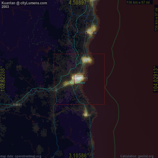
» NASA city lights 2003
» Earth at Night: Flat Maps 2012, 2016