Kertih night lights from space
Night Light of Kertih (Terengganu) from space (Malaysia) Src. Average luminocity for 10x10km area is 37.7479% and for 50x50km: 9.9338%.
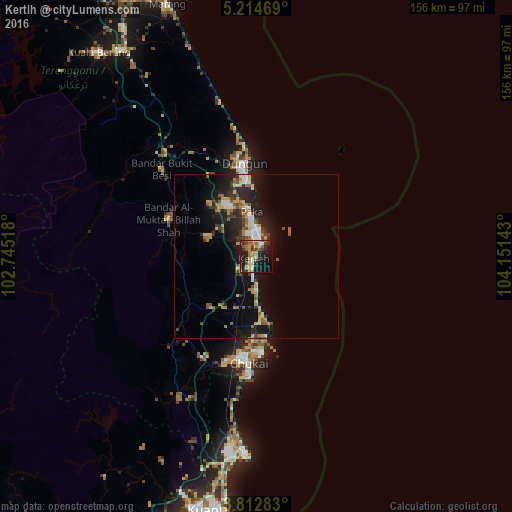
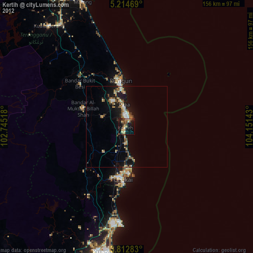
Analysis of Kertih night lights 2016
Square area 10x10 km:
 3.31%
3.31%90-99
3.1%80-89
3.72%70-79
8.06%60-69
10.54%50-59
5.99%40-49
5.37%30-39
6.2%20-29
9.5%10-19
35.12%0-9
9.09%Square area 50x50 km:
0.93%90-99
1.14%80-89
0.98%70-79
1.69%60-69
1.46%50-59
1.3%40-49
1.21%30-39
1.69%20-29
3.59%10-19
8.83%0-9
77.18%Clear (daylight) street map image can be seen on geolist.org.
Map coordinates:
5° 12' 52.9" North, 102° 44' 42.6" East
4° 30' 50.8" North, 103° 26' 53.9" East
3° 48' 46.2" North, 104° 9' 5.1" East
Some cities around Kertih sort by population:
• Kuantan
79.7 km =49.5 mi,  189°
189°
• Kuala Terengganu
96.9 km =60.2 mi,  339°
339°
• Cukai
29.6 km =18.4 mi, 186°
• Jerantut
136.5 km =84.8 mi,  241°
241°
• Pekan
114.7 km =71.3 mi,  182°
182°
• Marang
81.4 km =50.6 mi, 340°
• Paka
13.8 km =8.6 mi,  354°
354°
• Kuala Lipis
159.7 km =99.2 mi,  256°
256°
1734316 (p: 24,401)
Sources (retrieved 2019-11-25):
» Earth at Night: Flat Maps 2012, 2016