Kuala Lipis night lights from space
Night Light of Kuala Lipis (Pahang) from space (Malaysia) Src. Average luminocity for 10x10km area is 9.1645% and for 50x50km: 0.6974%.
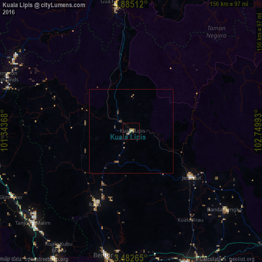
Analysis of Kuala Lipis night lights 2016
Square area 10x10 km:
 0%
0%90-99
0.43%80-89
2.16%70-79
3.46%60-69
1.73%50-59
1.73%40-49
0%30-39
0.22%20-29
1.73%10-19
0.65%0-9
87.88%Square area 50x50 km:
0%90-99
0.02%80-89
0.08%70-79
0.17%60-69
0.2%50-59
0.1%40-49
0.24%30-39
0.08%20-29
0.08%10-19
0.14%0-9
98.89%Clear (daylight) street map image can be seen on geolist.org.
Map coordinates:
4° 53' 6.4" North, 101° 20' 37.2" East
4° 11' 3.1" North, 102° 2' 48.5" East
3° 28' 57.5" North, 102° 44' 59.7" East
Some cities around Kuala Lipis sort by population:
• Temerluh
91.4 km =56.8 mi,  153°
153°
• Bentong Town
75.2 km =46.7 mi,  191°
191°
• Mentekab
84.6 km =52.6 mi,  156°
156°
• Raub
48.6 km =30.2 mi,  205°
205°
• Jerantut
44.6 km =27.7 mi,  128°
128°
• Bidur
85 km =52.8 mi,  264°
264°
• Gua Musang
78.3 km =48.7 mi,  353°
353°
• Tanah Rata
80.6 km =50.1 mi,  292°
292°
1733023 (p: 15,448)
Sources (retrieved 2019-11-25):
» Earth at Night: Flat Maps 2012, 2016