Jitra night lights from space
Night Light of Jitra (Kedah) from space (Malaysia) Src. Average luminocity for 10x10km area is 48.3636% and for 50x50km: 19.8636%.
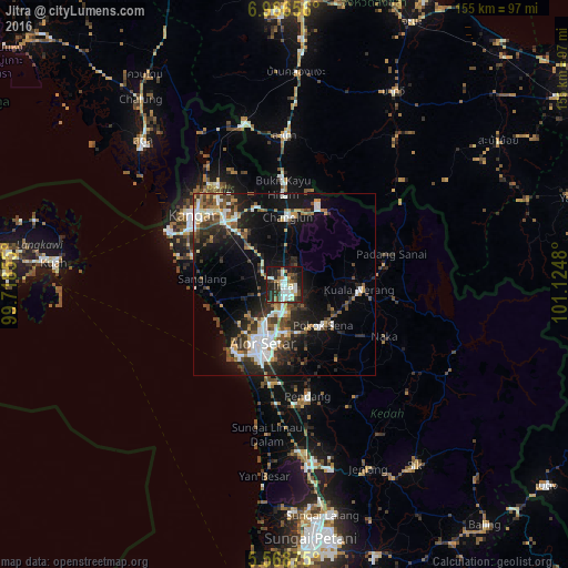
Analysis of Jitra night lights 2016
Square area 10x10 km:
 11.9%
11.9%90-99
11.04%80-89
4.11%70-79
4.33%60-69
2.6%50-59
4.76%40-49
6.71%30-39
9.96%20-29
19.7%10-19
24.03%0-9
0.87%Square area 50x50 km:
3.68%90-99
3.6%80-89
1.16%70-79
1.92%60-69
1.94%50-59
2.79%40-49
3.05%30-39
3.7%20-29
7.04%10-19
13.52%0-9
57.61%Clear (daylight) street map image can be seen on geolist.org.
Map coordinates:
6° 57' 59.6" North, 99° 43' 6.8" East
6° 16' 5.2" North, 100° 25' 18" East
5° 34' 7.5" North, 101° 7' 29.3" East
Some cities around Jitra sort by population:
• Alor Setar
17.7 km =11 mi,  202°
202°
• Kangar
31.3 km =19.4 mi,  308°
308°
• Bedong
60.9 km =37.8 mi,  170°
170°
• Sadao, TH
41.2 km =25.6 mi,  0°
0°
• Satun, TH
55.6 km =34.5 mi,  315°
315°
• Kuala Kedah
23 km =14.3 mi,  215°
215°
• Gurun
50.5 km =31.4 mi, 173°
• Kuala Perlis
35.1 km =21.8 mi,  294°
294°
1736302 (p: 63,489)
Sources (retrieved 2019-11-25):
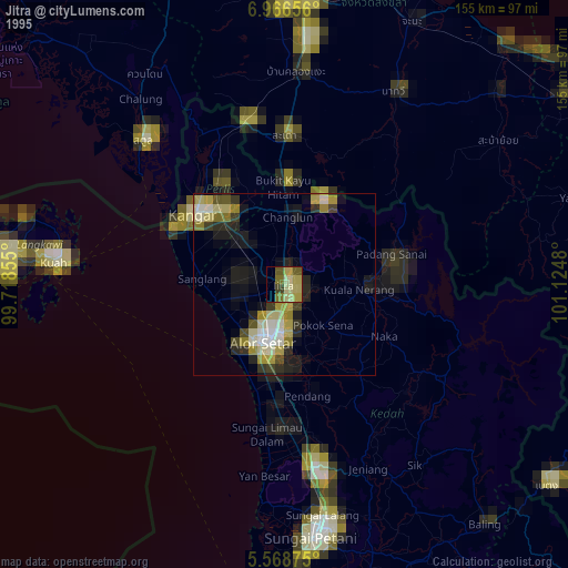
» NASA, Earths city lights 1995
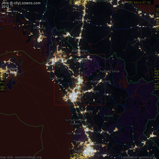
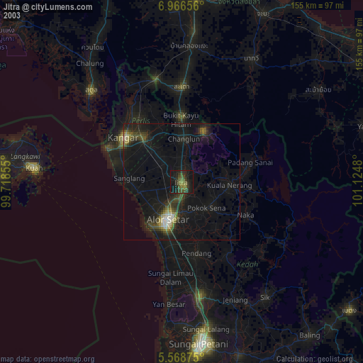
» NASA city lights 2003
» Earth at Night: Flat Maps 2012, 2016