Gurun night lights from space
Night Light of Gurun (Kedah) from space (Malaysia) Src. Average luminocity for 10x10km area is 37.469% and for 50x50km: 14.1884%.
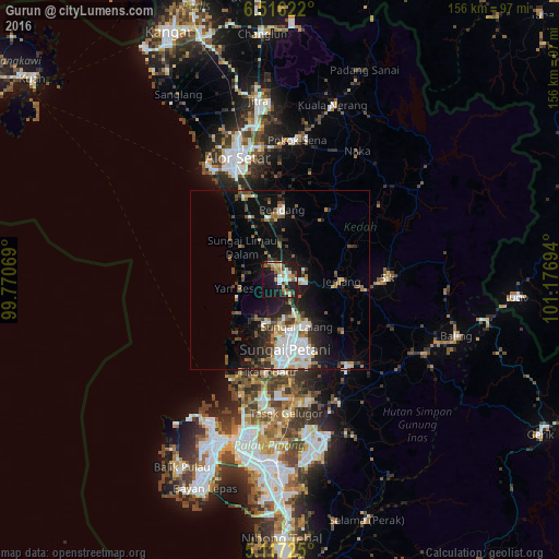
Analysis of Gurun night lights 2016
Square area 10x10 km:
 3.72%
3.72%90-99
7.64%80-89
4.55%70-79
6.4%60-69
4.13%50-59
5.17%40-49
7.02%30-39
1.86%20-29
8.88%10-19
39.67%0-9
10.95%Square area 50x50 km:
2.93%90-99
2.39%80-89
1.06%70-79
1.14%60-69
1.69%50-59
1.8%40-49
2.19%30-39
1.96%20-29
3.57%10-19
9.9%0-9
71.36%Clear (daylight) street map image can be seen on geolist.org.
Map coordinates:
6° 30' 58.4" North, 99° 46' 14.5" East
5° 49' 1.8" North, 100° 28' 25.7" East
5° 7' 2.1" North, 101° 10' 37" East
Some cities around Gurun sort by population:
• Sungai Petani
19 km =11.8 mi,  175°
175°
• Alor Setar
36 km =22.4 mi,  339°
339°
• Tasek Glugor
37.6 km =23.4 mi, 175°
• Bedong
10.7 km =6.6 mi,  158°
158°
• Permatang Kuching
40.6 km =25.2 mi,  194°
194°
• Tanjung Tokong
43.7 km =27.2 mi,  204°
204°
• Kuala Kedah
36.9 km =22.9 mi,  328°
328°
• Kepala Batas
33.8 km =21 mi, 188°
1735485 (p: 15,964)
Sources (retrieved 2019-11-25):
» Earth at Night: Flat Maps 2012, 2016