Villa Union night lights from space
Night Light of Villa Union (Coahuila) from space (Mexico) Src. Average luminocity for 10x10km area is 4.8413% and for 50x50km: 1.7562%.
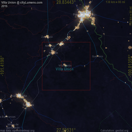
Analysis of Villa Union night lights 2016
Square area 10x10 km:
 0%
0%90-99
0%80-89
0%70-79
0.79%60-69
2.18%50-59
1.79%40-49
1.19%30-39
0.6%20-29
1.59%10-19
1.19%0-9
90.67%Square area 50x50 km:
0.02%90-99
0.07%80-89
0.28%70-79
0.38%60-69
0.43%50-59
0.34%40-49
0.32%30-39
0.21%20-29
0.18%10-19
0.23%0-9
97.53%Clear (daylight) street map image can be seen on geolist.org.
Map coordinates:
28° 50' 3.9" North, 101° 25' 11.3" West
28° 13' 0" North, 100° 43' 0" West
27° 35' 43.1" North, 100° 0' 48.8" West
Some cities around Villa Union sort by population:
• Piedras Negras
57 km =35.4 mi,  19°
19°
• Sabinas
56.2 km =34.9 mi,  224°
224°
• Nueva Rosita
58 km =36 mi,  238°
238°
• Nava
23.2 km =14.4 mi,  348°
348°
• Allende
19.1 km =11.9 mi,  316°
316°
• Zaragoza
36.7 km =22.8 mi,  326°
326°
• Eidson Road, US
55.9 km =34.7 mi, 23°
• Morelos
27 km =16.8 mi, 321°
3980123 (p: 5,147)
Sources (retrieved 2019-11-25):
» Earth at Night: Flat Maps 2012, 2016