Sabinas night lights from space
Night Light of Sabinas (Coahuila) from space (Mexico) Src. Average luminocity for 10x10km area is 35.7443% and for 50x50km: 3.4992%.
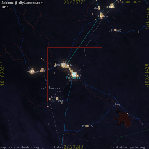
Analysis of Sabinas night lights 2016
Square area 10x10 km:
 4.17%
4.17%90-99
5.68%80-89
7.39%70-79
7.77%60-69
4.73%50-59
2.65%40-49
2.65%30-39
1.89%20-29
4.73%10-19
38.64%0-9
19.7%Square area 50x50 km:
0.28%90-99
0.39%80-89
0.63%70-79
0.59%60-69
0.5%50-59
0.37%40-49
0.33%30-39
0.28%20-29
0.52%10-19
4.03%0-9
92.06%Clear (daylight) street map image can be seen on geolist.org.
Map coordinates:
28° 28' 32.8" North, 101° 49' 13.8" West
27° 51' 21.3" North, 101° 7' 2.6" West
27° 13' 57" North, 100° 24' 51.3" West
Some cities around Sabinas sort by population:
• Nueva Rosita
13.6 km =8.5 mi,  313°
313°
• Ciudad Melchor Múzquiz
39.3 km =24.4 mi,  273°
273°
• Allende
60 km =37.3 mi,  25°
25°
• Palau
30.3 km =18.8 mi,  277°
277°
• Minas de Barroterán
27.9 km =17.3 mi,  215°
215°
• Morelos
65.2 km =40.5 mi,  20°
20°
• Villa Unión
56 km =34.8 mi,  43°
43°
• Villa Union
56.2 km =34.9 mi, 44°
3988333 (p: 54,905)
Sources (retrieved 2019-11-25):
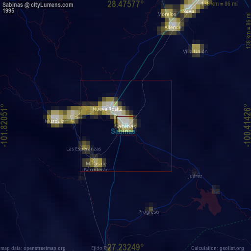
» NASA, Earths city lights 1995
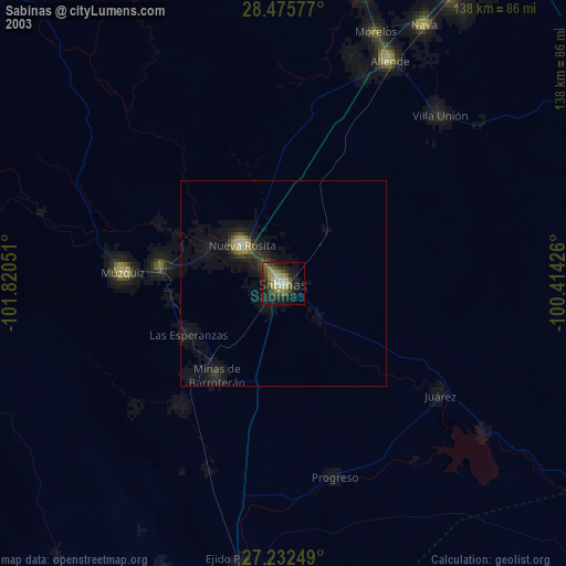
» NASA city lights 2003
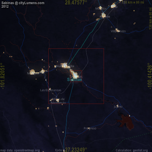
» Earth at Night: Flat Maps 2012, 2016