Nava night lights from space
Night Light of Nava (Coahuila) from space (Mexico) Src. Average luminocity for 10x10km area is 16.7718% and for 50x50km: 3.7856%.
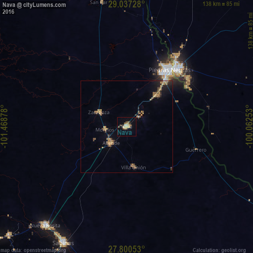
Analysis of Nava night lights 2016
Square area 10x10 km:
 0.6%
0.6%90-99
1.79%80-89
4.37%70-79
2.78%60-69
1.59%50-59
3.77%40-49
1.19%30-39
2.98%20-29
0%10-19
1.59%0-9
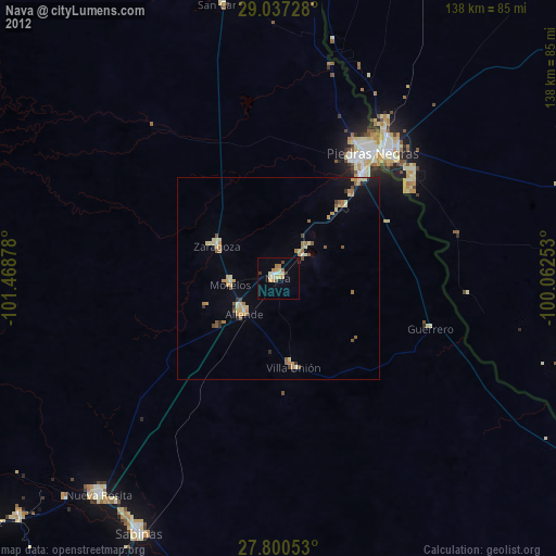
79.37%Square area 50x50 km:
0.03%90-99
0.14%80-89
0.48%70-79
0.77%60-69
0.96%50-59
0.79%40-49
0.57%30-39
0.52%20-29
0.71%10-19
1.56%0-9
93.47%Clear (daylight) street map image can be seen on geolist.org.
Map coordinates:
29° 2' 14.2" North, 101° 28' 7.6" West
28° 25' 14.6" North, 100° 45' 56.3" West
27° 48' 1.9" North, 100° 3' 45.1" West
Some cities around Nava sort by population:
• Piedras Negras
39 km =24.2 mi,  37°
37°
• Eagle Pass, US
41.3 km =25.7 mi, 39°
• Allende
12.2 km =7.6 mi,  223°
223°
• Zaragoza
17.3 km =10.7 mi,  297°
297°
• Eidson Road, US
39.4 km =24.5 mi, 43°
• Morelos
12.1 km =7.5 mi,  262°
262°
• Villa Unión
22.4 km =13.9 mi,  170°
170°
• Villa Union
23.2 km =14.4 mi, 168°
3995050 (p: 22,192)
Sources (retrieved 2019-11-25):
» Earth at Night: Flat Maps 2012, 2016