Zaragoza night lights from space
Night Light of Zaragoza (Coahuila) from space (Mexico) Src. Average luminocity for 10x10km area is 8.5615% and for 50x50km: 2.2743%.
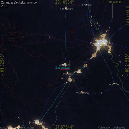
Analysis of Zaragoza night lights 2016
Square area 10x10 km:
 0%
0%90-99
0%80-89
1.79%70-79
1.59%60-69
3.77%50-59
1.59%40-49
0.79%30-39
1.59%20-29
0%10-19
0%0-9
88.89%Square area 50x50 km:
0.03%90-99
0.09%80-89
0.41%70-79
0.43%60-69
0.56%50-59
0.42%40-49
0.35%30-39
0.32%20-29
0.2%10-19
0.18%0-9
97.01%Clear (daylight) street map image can be seen on geolist.org.
Map coordinates:
29° 6' 33.6" North, 101° 37' 31.5" West
28° 29' 35.5" North, 100° 55' 20.3" West
27° 52' 24.4" North, 100° 13' 9" West
Some cities around Zaragoza sort by population:
• Piedras Negras
45.2 km =28.1 mi,  59°
59°
• Eagle Pass, US
47.7 km =29.6 mi, 59°
• Nava
17.3 km =10.7 mi,  117°
117°
• Allende
18.3 km =11.4 mi,  157°
157°
• Eidson Road, US
47.2 km =29.3 mi, 64°
• Morelos
10.2 km =6.3 mi, 161°
• Villa Unión
35.7 km =22.2 mi,  147°
147°
• Villa Union
36.7 km =22.8 mi, 146°
3979706 (p: 10,461)
Sources (retrieved 2019-11-25):
» Earth at Night: Flat Maps 2012, 2016