Eidson Road night lights from space
Night Light of Eidson Road (Texas) from space (United States) Src. Average luminocity for 10x10km area is 62.2519% and for 50x50km: 8.7561%.
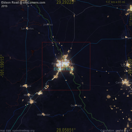
Analysis of Eidson Road night lights 2016
Square area 10x10 km:
 16.1%
16.1%90-99
15.53%80-89
7.58%70-79
6.06%60-69
9.09%50-59
6.82%40-49
3.79%30-39
10.23%20-29
17.8%10-19
7.01%0-9
0%Square area 50x50 km:
1.19%90-99
1.43%80-89
1%70-79
1.44%60-69
1.3%50-59
1.1%40-49
0.99%30-39
1.18%20-29
2.58%10-19
5.29%0-9
82.5%Clear (daylight) street map image can be seen on geolist.org.
Map coordinates:
29° 17' 32.1" North, 101° 11' 24.5" West
28° 40' 37.9" North, 100° 29' 13.3" West
28° 3' 30.6" North, 99° 47' 2" West
Some cities around Eidson Road sort by population:
• Piedras Negras, MX
4.4 km =2.7 mi,  305°
305°
• Eagle Pass
3.8 km =2.4 mi,  341°
341°
• Nava, MX
39.4 km =24.5 mi,  223°
223°
• Allende, MX
51.6 km =32.1 mi, 223°
• Zaragoza, MX
47.2 km =29.3 mi,  244°
244°
• Morelos, MX
49.4 km =30.7 mi,  232°
232°
• Villa Unión, MX
55.7 km =34.6 mi,  204°
204°
• Villa Union, MX
55.9 km =34.7 mi, 203°
5520953 (p: 8,960)
Sources (retrieved 2019-11-25):
» Earth at Night: Flat Maps 2012, 2016