Villa de Arriaga night lights from space
Night Light of Villa de Arriaga (San Luis Potosí) from space (Mexico) Src. Average luminocity for 10x10km area is 3.7183% and for 50x50km: 1.3317%.
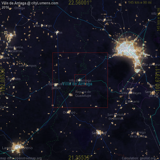
Analysis of Villa de Arriaga night lights 2016
Square area 10x10 km:
 0%
0%90-99
0%80-89
0.4%70-79
1.19%60-69
1.59%50-59
0%40-49
0.79%30-39
0.79%20-29
0.79%10-19
0.79%0-9
93.65%Square area 50x50 km:
0.05%90-99
0.09%80-89
0.23%70-79
0.26%60-69
0.19%50-59
0.26%40-49
0.28%30-39
0.31%20-29
0.28%10-19
0.22%0-9
97.82%Clear (daylight) street map image can be seen on geolist.org.
Map coordinates:
22° 33' 36" North, 102° 5' 7.3" West
21° 54' 33" North, 101° 22' 56" West
21° 15' 19.3" North, 100° 40' 44.8" West
Some cities around Villa de Arriaga sort by population:
• San Luis Potosí
49.4 km =30.7 mi,  57°
57°
• Soledad de Graciano Sánchez
55.4 km =34.4 mi, 55°
• San Felipe
50.9 km =31.6 mi,  160°
160°
• Ojuelos de Jalisco
22.2 km =13.8 mi,  257°
257°
• La Pila
54.8 km =34.1 mi,  75°
75°
• Ocampo
30.9 km =19.2 mi,  199°
199°
• San Bartolo de Berrios
46.2 km =28.7 mi,  135°
135°
• Pinos
47.4 km =29.5 mi,  335°
335°
4018209 (p: 5,426)
Sources (retrieved 2019-11-25):
» Earth at Night: Flat Maps 2012, 2016