Soledad de Graciano Sánchez night lights from space
Night Light of Soledad de Graciano Sánchez (San Luis Potosí) from space (Mexico) Src. Average luminocity for 10x10km area is 82.0057% and for 50x50km: 19.4437%.
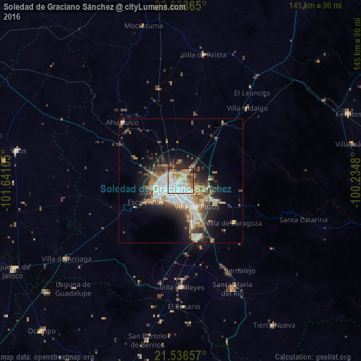
Analysis of Soledad de Graciano Sánchez night lights 2016
Square area 10x10 km:
 28.6%
28.6%90-99
22.35%80-89
10.61%70-79
14.02%60-69
7.95%50-59
6.06%40-49
4.55%30-39
4.17%20-29
1.7%10-19
0%0-9
0%Square area 50x50 km:
4.13%90-99
3.54%80-89
1.91%70-79
2.64%60-69
2.52%50-59
2.6%40-49
2.83%30-39
3.11%20-29
4.52%10-19
7.47%0-9
64.72%Clear (daylight) street map image can be seen on geolist.org.
Map coordinates:
22° 50' 19.1" North, 101° 38' 27.8" West
22° 11' 20.8" North, 100° 56' 16.5" West
21° 32' 11.7" North, 100° 14' 5.3" West
Some cities around Soledad de Graciano Sánchez sort by population:
• San Luis Potosí
6.1 km =3.8 mi,  224°
224°
• Santa María del Río
48.3 km =30 mi,  154°
154°
• Villa de Reyes
42.9 km =26.7 mi,  179°
179°
• Villa Zaragoza
27.2 km =16.9 mi,  128°
128°
• Villa de Arista
51.3 km =31.9 mi,  10°
10°
• La Pila
18.7 km =11.6 mi,  157°
157°
• San Bartolo de Berrios
65.5 km =40.7 mi,  191°
191°
• Villa de Arriaga
55.4 km =34.4 mi,  235°
235°
3982912 (p: 255,015)
Sources (retrieved 2019-11-25):
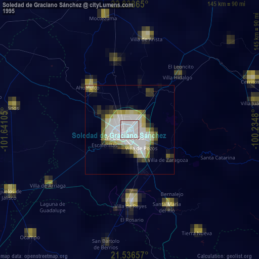
» NASA, Earths city lights 1995
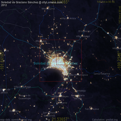
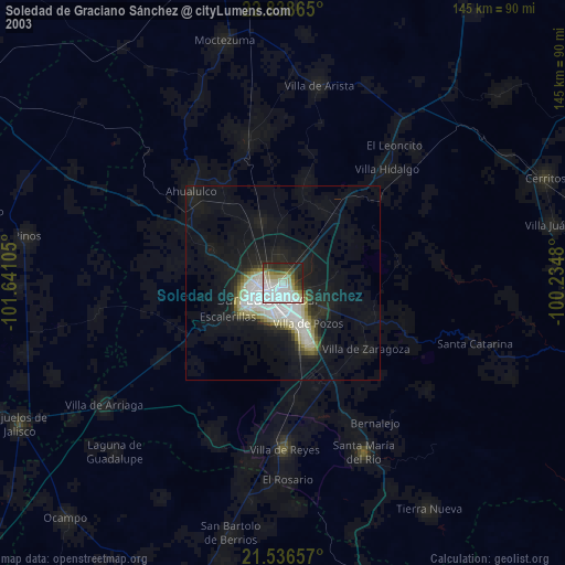
» NASA city lights 2003
» Earth at Night: Flat Maps 2012, 2016