San Bartolo de Berrios night lights from space
Night Light of San Bartolo de Berrios (Guanajuato) from space (Mexico) Src. Average luminocity for 10x10km area is 4.5587% and for 50x50km: 3.1383%.
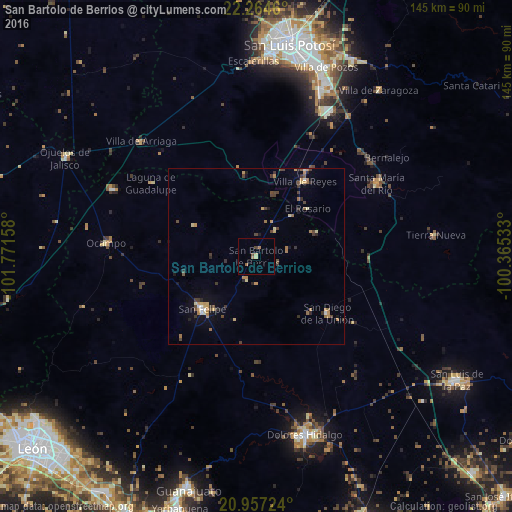
Analysis of San Bartolo de Berrios night lights 2016
Square area 10x10 km:
 0%
0%90-99
0%80-89
1.52%70-79
0.38%60-69
1.52%50-59
0.38%40-49
1.52%30-39
0%20-29
0%10-19
0%0-9
94.7%Square area 50x50 km:
0.14%90-99
0.14%80-89
0.45%70-79
0.67%60-69
0.66%50-59
0.28%40-49
0.78%30-39
0.64%20-29
0.43%10-19
0.77%0-9
95.04%Clear (daylight) street map image can be seen on geolist.org.
Map coordinates:
22° 15' 52.6" North, 101° 46' 17.7" West
21° 36' 44.6" North, 101° 4' 6.4" West
20° 57' 26.1" North, 100° 21' 55.2" West
Some cities around San Bartolo de Berrios sort by population:
• San Felipe
21.3 km =13.2 mi,  225°
225°
• Santa María del Río
39.8 km =24.7 mi,  59°
59°
• Villa de Reyes
25.3 km =15.7 mi,  33°
33°
• San Diego de la Unión
25.8 km =16 mi,  128°
128°
• La Pila
51.3 km =31.9 mi,  23°
23°
• Ocampo
42.7 km =26.5 mi,  275°
275°
• Villa de Arriaga
46.2 km =28.7 mi,  315°
315°
• Tierra Nueva
51.6 km =32.1 mi,  82°
82°
3987591 (p: 5,899)
Sources (retrieved 2019-11-25):
» Earth at Night: Flat Maps 2012, 2016