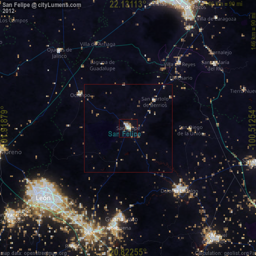
San Felipe night lights from space
Night Light of San Felipe (Guanajuato) from space (Mexico) Src. Average luminocity for 10x10km area is 19.6932% and for 50x50km: 2.0784%.

Analysis of San Felipe night lights 2016
Square area 10x10 km:
 1.7%
1.7%90-99
2.08%80-89
2.65%70-79
5.87%60-69
2.08%50-59
0.76%40-49
2.46%30-39
3.41%20-29
1.33%10-19
10.42%0-9
67.23%Square area 50x50 km:
0.07%90-99
0.1%80-89
0.35%70-79
0.45%60-69
0.32%50-59
0.18%40-49
0.61%30-39
0.45%20-29
0.27%10-19
0.6%0-9
96.61%Clear (daylight) street map image can be seen on geolist.org.
Map coordinates:
22° 7' 52.1" North, 101° 55' 7.6" West
21° 28' 41.9" North, 101° 12' 56.4" West
20° 49' 21.2" North, 100° 30' 45.1" West
Some cities around San Felipe sort by population:
• Guanajuato
51.3 km =31.9 mi,  185°
185°
• Dolores Hidalgo Cuna de la Independencia Nacional
46.3 km =28.8 mi,  140°
140°
• Villa de Reyes
46.4 km =28.8 mi,  38°
38°
• San Diego de la Unión
35.5 km =22.1 mi,  91°
91°
• Ocampo
33.1 km =20.6 mi,  304°
304°
• Duarte
54 km =33.6 mi,  216°
216°
• San Bartolo de Berrios
21.3 km =13.2 mi,  45°
45°
• Villa de Arriaga
50.9 km =31.6 mi,  340°
340°
3987246 (p: 28,452)
Sources (retrieved 2019-11-25):
» Earth at Night: Flat Maps 2012, 2016