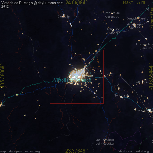
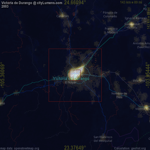
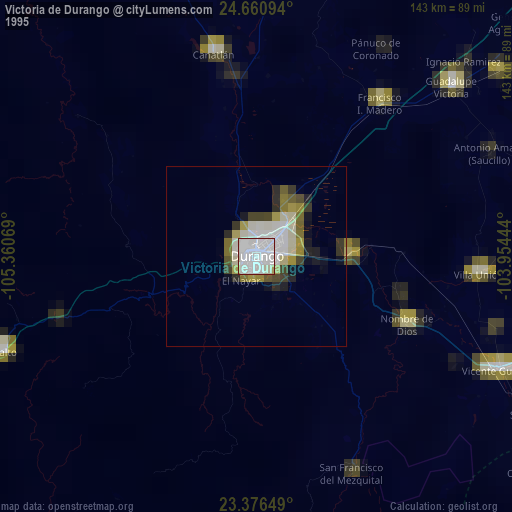
Victoria de Durango night lights from space
Night Light of Victoria de Durango (Durango) from space (Mexico) Src. Average luminocity for 10x10km area is 87.1042% and for 50x50km: 9.5127%.
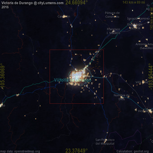
Analysis of Victoria de Durango night lights 2016
Square area 10x10 km:
 26.52%
90-99
35.04%80-89
15.34%70-79
13.07%60-69
0%50-59
3.03%40-49
3.22%30-39
2.46%20-29
1.33%10-19
0%0-9
0%Square area 50x50 km:
1.22%90-99
1.99%80-89
1.63%70-79
1.61%60-69
0.46%50-59
0.83%40-49
1.44%30-39
1.22%20-29
2.53%10-19
5.07%0-9
81.98%Clear (daylight) street map image can be seen on geolist.org.
Map coordinates:
24° 39' 39.4" North, 105° 21' 38.5" West
24° 1' 13.2" North, 104° 39' 27.2" West
23° 22' 35.4" North, 103° 57' 16" West
Some cities around Victoria de Durango sort by population:
• El Salto
76.5 km =47.5 mi,  249°
249°
• Pueblo Nuevo
102.7 km =63.8 mi,  226°
226°
• Ciudad Guadalupe Victoria
71.9 km =44.7 mi,  49°
49°
• Vicente Guerrero
75.4 km =46.9 mi,  114°
114°
• Canatlán
57.4 km =35.7 mi,  348°
348°
• Nuevo Ideal
105.1 km =65.3 mi,  336°
336°
• Villa Unión
62.2 km =38.6 mi,  94°
94°
• Nombre de Dios
45.9 km =28.5 mi, 114°
4011743 (p: 518,709)
Sources (retrieved 2019-11-25):
» NASA, Earths city lights 1995
» NASA city lights 2003
» Earth at Night: Flat Maps 2012, 2016