Nombre de Dios night lights from space
Night Light of Nombre de Dios (Durango) from space (Mexico) Src. Average luminocity for 10x10km area is 4.2619% and for 50x50km: 1.5509%.
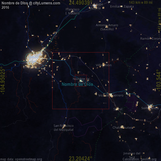
Analysis of Nombre de Dios night lights 2016
Square area 10x10 km:
 0%
0%90-99
1.59%80-89
0.79%70-79
0.6%60-69
0.6%50-59
0.4%40-49
0.79%30-39
0%20-29
0%10-19
0%0-9
95.24%Square area 50x50 km:
0%90-99
0.1%80-89
0.25%70-79
0.36%60-69
0.25%50-59
0.21%40-49
0.49%30-39
0.26%20-29
0.37%10-19
0.26%0-9
97.46%Clear (daylight) street map image can be seen on geolist.org.
Map coordinates:
24° 29' 25.4" North, 104° 57' 0.9" West
23° 50' 56.1" North, 104° 14' 49.6" West
23° 12' 15.3" North, 103° 32' 38.4" West
Some cities around Nombre de Dios sort by population:
• Victoria de Durango
45.9 km =28.5 mi,  294°
294°
• Sombrerete
66 km =41 mi,  111°
111°
• Ciudad Guadalupe Victoria
67.4 km =41.9 mi,  10°
10°
• Vicente Guerrero
29.6 km =18.4 mi,  115°
115°
• Juan Aldama
99.7 km =62 mi,  60°
60°
• Miguel Auza
94.8 km =58.9 mi, 58°
• Canatlán
92.3 km =57.4 mi,  324°
324°
• Villa Unión
24.7 km =15.3 mi, 55°
3994863 (p: 5,302)
Sources (retrieved 2019-11-25):
» Earth at Night: Flat Maps 2012, 2016