Ciudad Guadalupe Victoria night lights from space
Night Light of Ciudad Guadalupe Victoria (Durango) from space (Mexico) Src. Average luminocity for 10x10km area is 13.8631% and for 50x50km: 1.5413%.
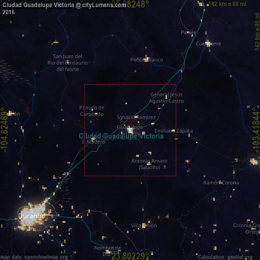
Analysis of Ciudad Guadalupe Victoria night lights 2016
Square area 10x10 km:
 1.79%
1.79%90-99
2.18%80-89
1.59%70-79
1.59%60-69
1.98%50-59
3.57%40-49
0.79%30-39
0.79%20-29
0%10-19
1.79%0-9
83.93%Square area 50x50 km:
0.09%90-99
0.24%80-89
0.34%70-79
0.34%60-69
0.09%50-59
0.22%40-49
0.25%30-39
0.12%20-29
0.17%10-19
0.17%0-9
97.98%Clear (daylight) street map image can be seen on geolist.org.
Map coordinates:
25° 4' 56.9" North, 104° 49' 28.9" West
24° 26' 38.4" North, 104° 7' 17.6" West
23° 48' 8.2" North, 103° 25' 6.4" West
Some cities around Ciudad Guadalupe Victoria sort by population:
• Victoria de Durango
71.9 km =44.7 mi,  229°
229°
• Juan Aldama
75.7 km =47 mi,  102°
102°
• Miguel Auza
69.9 km =43.4 mi, 103°
• Canatlán
66.6 km =41.4 mi,  277°
277°
• Villa Unión
52.7 km =32.7 mi,  171°
171°
• Cuencamé de Ceniceros
64 km =39.8 mi,  42°
42°
• Nombre de Dios
67.4 km =41.9 mi,  190°
190°
• Peñón Blanco
40 km =24.9 mi,  13°
13°
4005380 (p: 16,506)
Sources (retrieved 2019-11-25):
» Earth at Night: Flat Maps 2012, 2016