Tlaquepaque night lights from space
Night Light of Tlaquepaque (Jalisco) from space (Mexico) Src. Average luminocity for 10x10km area is 99.3201% and for 50x50km: 52.5185%.
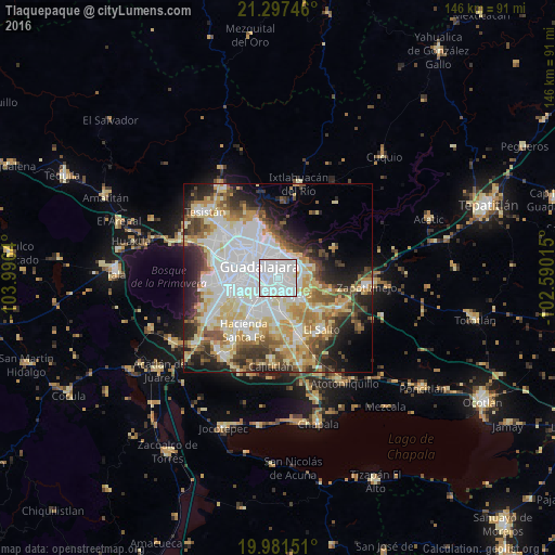
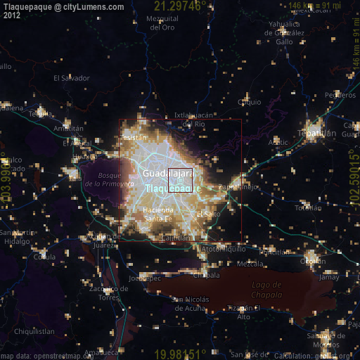
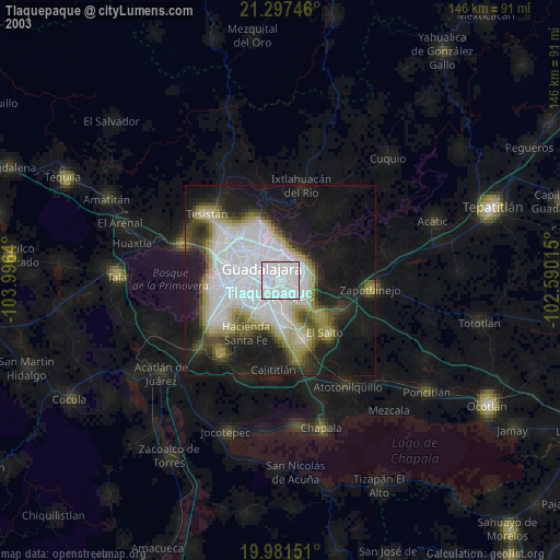
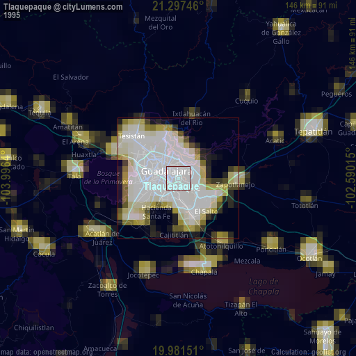
Analysis of Tlaquepaque night lights 2016
Square area 10x10 km:
 73.67%
90-99
24.43%80-89
1.7%70-79
0.19%60-69
0%50-59
0%40-49
0%30-39
0%20-29
0%10-19
0%0-9
0%Square area 50x50 km:
16.33%90-99
10.19%80-89
8.98%70-79
7.03%60-69
4.29%50-59
4.83%40-49
5.75%30-39
5.47%20-29
7.67%10-19
8.95%0-9
20.51%Clear (daylight) street map image can be seen on geolist.org.
Map coordinates:
21° 17' 50.9" North, 103° 59' 47" West
20° 38' 27.3" North, 103° 17' 35.8" West
19° 58' 53.4" North, 102° 35' 24.5" West
Some cities around Tlaquepaque sort by population:
• Guadalajara
10.7 km =6.6 mi,  285°
285°
• Zapopan
13.2 km =8.2 mi,  313°
313°
• Tonalá
6.4 km =4 mi,  106°
106°
• Coyula
7.2 km =4.5 mi,  74°
74°
• Las Pintitas
8.6 km =5.3 mi,  186°
186°
• Las Pintas de Arriba
8.1 km =5 mi,  202°
202°
• El Quince
10.8 km =6.7 mi,  175°
175°
• El Verde
9.6 km =6 mi,  171°
171°
3981461 (p: 575,942)
Sources (retrieved 2019-11-25):
» NASA, Earths city lights 1995
» NASA city lights 2003
» Earth at Night: Flat Maps 2012, 2016