Las Pintitas night lights from space
Night Light of Las Pintitas (Jalisco) from space (Mexico) Src. Average luminocity for 10x10km area is 93.8674% and for 50x50km: 51.7599%.
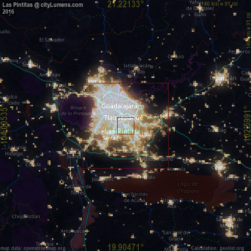
Analysis of Las Pintitas night lights 2016
Square area 10x10 km:
 39.02%
90-99
33.52%80-89
17.05%70-79
10.23%60-69
0.19%50-59
0%40-49
0%30-39
0%20-29
0%10-19
0%0-9
0%Square area 50x50 km:
16%90-99
9.95%80-89
8.86%70-79
6.82%60-69
4.17%50-59
4.5%40-49
5.54%30-39
5.36%20-29
7.61%10-19
10.92%0-9
20.27%Clear (daylight) street map image can be seen on geolist.org.
Map coordinates:
21° 13' 16.8" North, 104° 0' 19.3" West
20° 33' 52" North, 103° 18' 8" West
19° 54' 17" North, 102° 35' 56.8" West
Some cities around Las Pintitas sort by population:
• Tlaquepaque
8.6 km =5.3 mi,  6°
6°
• El Quince
2.9 km =1.8 mi,  141°
141°
• San José del Castillo
8.7 km =5.4 mi,  129°
129°
• Real del Valle (El Paraíso) [Fraccionamiento]
7.3 km =4.5 mi,  253°
253°
• Villas de la Hacienda [Fraccionamiento]
9.2 km =5.7 mi, 246°
• Valle Dorado Inn
7.6 km =4.7 mi,  234°
234°
• La Alameda
9.5 km =5.9 mi, 143°
• El Verde
2.6 km =1.6 mi,  111°
111°
8858098 (p: 26,500)
Sources (retrieved 2019-11-25):
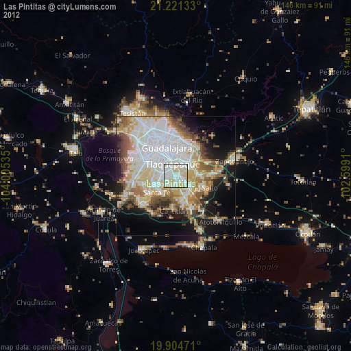
» Earth at Night: Flat Maps 2012, 2016