Tonalá night lights from space
Night Light of Tonalá (Jalisco) from space (Mexico) Src. Average luminocity for 10x10km area is 86.7235% and for 50x50km: 48.963%.
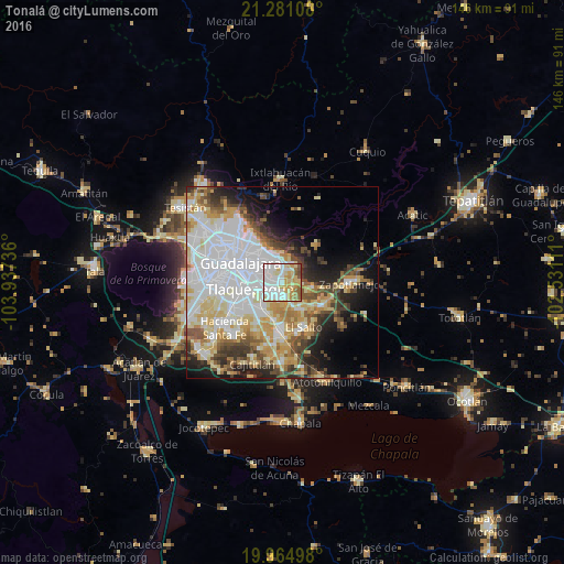
Analysis of Tonalá night lights 2016
Square area 10x10 km:
 31.25%
90-99
23.3%80-89
17.05%70-79
14.2%60-69
4.92%50-59
5.68%40-49
2.27%30-39
1.33%20-29
0%10-19
0%0-9
0%Square area 50x50 km:
15.92%90-99
9.55%80-89
8.48%70-79
6.2%60-69
3.99%50-59
4.34%40-49
5.24%30-39
4.22%20-29
5.91%10-19
8.63%0-9
27.51%Clear (daylight) street map image can be seen on geolist.org.
Map coordinates:
21° 16' 51.9" North, 103° 56' 14.5" West
20° 37' 28" North, 103° 14' 3.2" West
19° 57' 53.9" North, 102° 31' 52" West
Some cities around Tonalá sort by population:
• Tlaquepaque
6.4 km =4 mi,  286°
286°
• Coyula
3.9 km =2.4 mi,  11°
11°
• Las Pintitas
9.7 km =6 mi,  226°
226°
• Las Pintas de Arriba
10.9 km =6.8 mi,  238°
238°
• El Quince
10.4 km =6.5 mi,  210°
210°
• Centro de Readaptación Social
8.9 km =5.5 mi,  151°
151°
• El Verde
9 km =5.6 mi, 211°
• Puente Grande
10.3 km =6.4 mi,  125°
125°
3981369 (p: 408,759)
Sources (retrieved 2019-11-25):
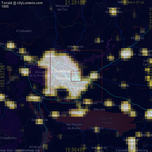
» NASA, Earths city lights 1995
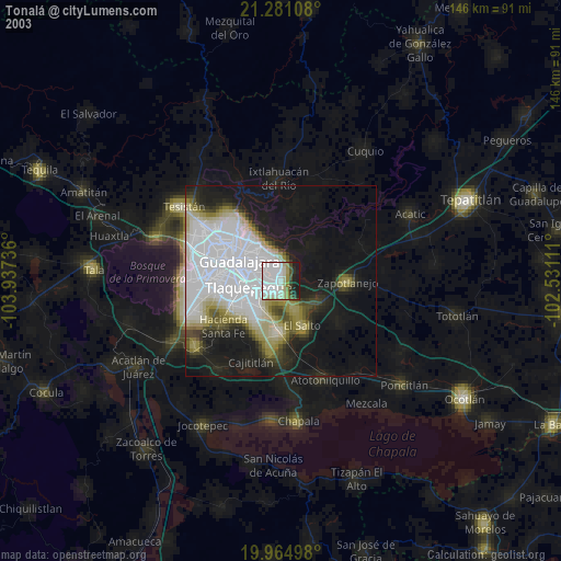
» NASA city lights 2003
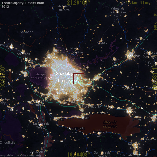
» Earth at Night: Flat Maps 2012, 2016