El Verde night lights from space
Night Light of El Verde (Jalisco) from space (Mexico) Src. Average luminocity for 10x10km area is 90.1193% and for 50x50km: 50.9348%.
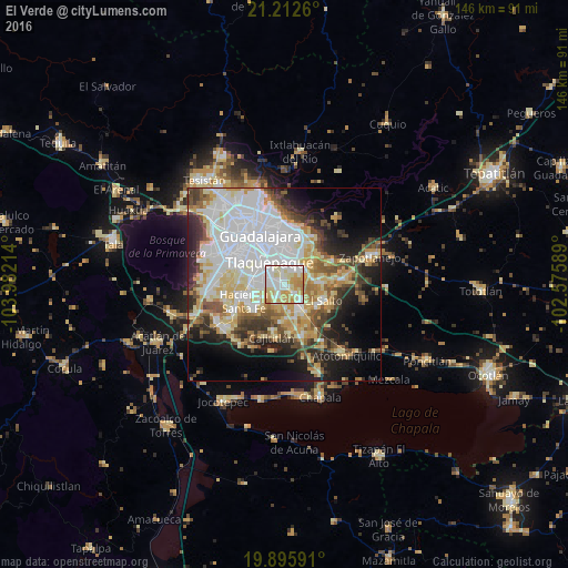
Analysis of El Verde night lights 2016
Square area 10x10 km:
 27.65%
90-99
29.92%80-89
20.45%70-79
18.37%60-69
3.6%50-59
0%40-49
0%30-39
0%20-29
0%10-19
0%0-9
0%Square area 50x50 km:
15.95%90-99
9.86%80-89
8.61%70-79
6.53%60-69
4.03%50-59
4.47%40-49
5.53%30-39
5.36%20-29
7.18%10-19
10.46%0-9
22.02%Clear (daylight) street map image can be seen on geolist.org.
Map coordinates:
21° 12' 45.4" North, 103° 58' 55.7" West
20° 33' 20.4" North, 103° 16' 44.4" West
19° 53' 45.3" North, 102° 34' 33.2" West
Some cities around El Verde sort by population:
• Tonalá
9 km =5.6 mi,  31°
31°
• Las Pintitas
2.6 km =1.6 mi,  291°
291°
• Las Pintas de Arriba
5 km =3.1 mi, 293°
• El Quince
1.4 km =0.9 mi,  204°
204°
• San José del Castillo
6.3 km =3.9 mi,  137°
137°
• Centro de Readaptación Social
8.9 km =5.5 mi,  90°
90°
• La Alameda
7.4 km =4.6 mi,  154°
154°
• Capulín
8.7 km =5.4 mi,  173°
173°
4006971 (p: 7,556)
Sources (retrieved 2019-11-25):
» Earth at Night: Flat Maps 2012, 2016