Zapopan night lights from space
Night Light of Zapopan (Jalisco) from space (Mexico) Src. Average luminocity for 10x10km area is 99.2216% and for 50x50km: 43.7328%.
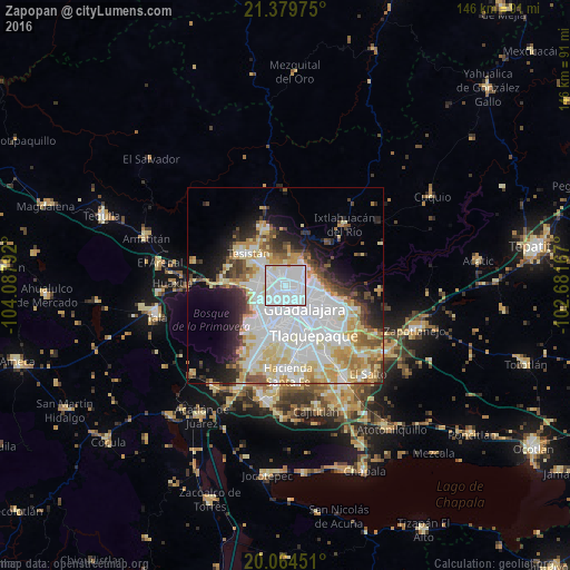
Analysis of Zapopan night lights 2016
Square area 10x10 km:
 75.57%
90-99
21.78%80-89
2.27%70-79
0.38%60-69
0%50-59
0%40-49
0%30-39
0%20-29
0%10-19
0%0-9
0%Square area 50x50 km:
15.59%90-99
9.22%80-89
7.13%70-79
5.46%60-69
2.76%50-59
2.99%40-49
3.39%30-39
3.11%20-29
4.97%10-19
8.27%0-9
37.1%Clear (daylight) street map image can be seen on geolist.org.
Map coordinates:
21° 22' 47.1" North, 104° 5' 16.5" West
20° 43' 24.8" North, 103° 23' 5.2" West
20° 3' 52.2" North, 102° 40' 54" West
Some cities around Zapopan sort by population:
• Guadalajara
6.4 km =4 mi,  186°
186°
• Tlaquepaque
13.2 km =8.2 mi,  133°
133°
• Tesistán
12.3 km =7.6 mi,  314°
314°
• Coyula
18 km =11.2 mi,  113°
113°
• Nuevo México
7.1 km =4.4 mi,  301°
301°
• Las Pintas de Arriba
17.8 km =11.1 mi,  159°
159°
• La Tijera
16.8 km =10.4 mi,  200°
200°
• La Venta del Astillero
16.7 km =10.4 mi,  271°
271°
3979770 (p: 1,142,483)
Sources (retrieved 2019-11-25):
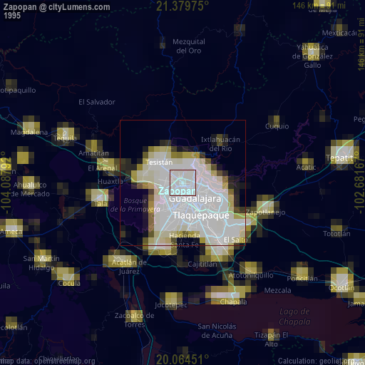
» NASA, Earths city lights 1995
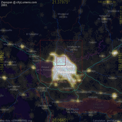
» NASA city lights 2003
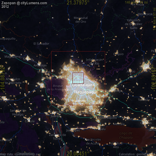
» Earth at Night: Flat Maps 2012, 2016