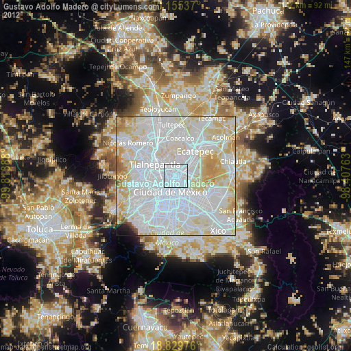
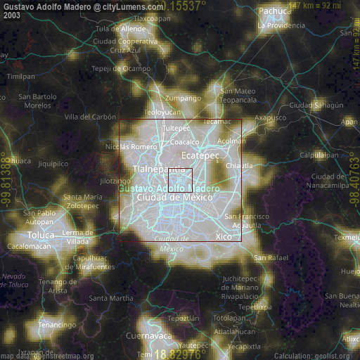
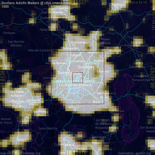
Gustavo Adolfo Madero night lights from space
Night Light of Gustavo Adolfo Madero (Mexico City) from space (Mexico) Src. Average luminocity for 10x10km area is 99.9649% and for 50x50km: 90.5592%.
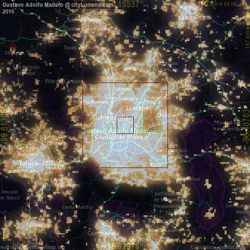
Analysis of Gustavo Adolfo Madero night lights 2016
Square area 10x10 km:
 97.31%
90-99
2.69%80-89
0%70-79
0%60-69
0%50-59
0%40-49
0%30-39
0%20-29
0%10-19
0%0-9
0%Square area 50x50 km:
49.67%90-99
18.47%80-89
11.7%70-79
9.96%60-69
5.3%50-59
2.36%40-49
1.04%30-39
0.63%20-29
0.59%10-19
0.28%0-9
0%Clear (daylight) street map image can be seen on geolist.org.
Map coordinates:
20° 9' 19.3" North, 99° 48' 50" West
19° 29' 38.1" North, 99° 6' 38.7" West
18° 49' 47.1" North, 98° 24' 27.5" West
Some cities around Gustavo Adolfo Madero sort by population:
• Mexico City
7.5 km =4.7 mi,  193°
193°
• Tlalnepantla
10.2 km =6.3 mi,  300°
300°
• Cuauhtémoc
6.6 km =4.1 mi,  214°
214°
• Venustiano Carranza
5.6 km =3.5 mi,  173°
173°
• Azcapotzalco
7.9 km =4.9 mi,  264°
264°
• Iztacalco
11.1 km =6.9 mi, 172°
• Colonia Lindavista
1.5 km =0.9 mi, 259°
• Puerto Escondido (Tepeolulco Puerto Escondido)
6.6 km =4.1 mi,  11°
11°
3514674 (p: 1,185,772)
Sources (retrieved 2019-11-25):
» NASA, Earths city lights 1995
» NASA city lights 2003
» Earth at Night: Flat Maps 2012, 2016