San Rafael night lights from space
Night Light of San Rafael (Veracruz) from space (Mexico) Src. Average luminocity for 10x10km area is 10.9345% and for 50x50km: 2.8774%.
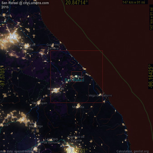
Analysis of San Rafael night lights 2016
Square area 10x10 km:
 0%
0%90-99
1.59%80-89
3.17%70-79
1.19%60-69
0%50-59
0.4%40-49
2.98%30-39
2.38%20-29
4.37%10-19
2.98%0-9
80.95%Square area 50x50 km:
0.07%90-99
0.25%80-89
0.64%70-79
0.36%60-69
0.24%50-59
0.25%40-49
0.7%30-39
0.66%20-29
0.66%10-19
1.63%0-9
94.53%Clear (daylight) street map image can be seen on geolist.org.
Map coordinates:
20° 50' 49.7" North, 97° 34' 13.8" West
20° 11' 19" North, 96° 52' 2.5" West
19° 31' 38.3" North, 96° 9' 51.3" West
Some cities around San Rafael sort by population:
• Martínez de la Torre
24.1 km =15 mi,  237°
237°
• Tlapacoyan
43.8 km =27.2 mi, 235°
• Misantla
28.8 km =17.9 mi,  176°
176°
• Villa Independencia
24.3 km =15.1 mi,  232°
232°
• Gutiérrez Zamora
37.2 km =23.1 mi,  322°
322°
• Vega de Alatorre
29.1 km =18.1 mi,  127°
127°
• Agua Dulce
48.5 km =30.1 mi,  293°
293°
• Villa Emilio Carranza
36.1 km =22.4 mi, 132°
3517915 (p: 6,515)
Sources (retrieved 2019-11-25):
» Earth at Night: Flat Maps 2012, 2016