Villa Independencia night lights from space
Night Light of Villa Independencia (Veracruz) from space (Mexico) Src. Average luminocity for 10x10km area is 27.9325% and for 50x50km: 3.7912%.
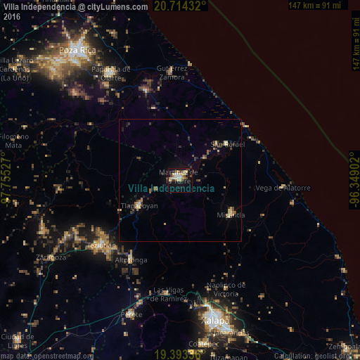
Analysis of Villa Independencia night lights 2016
Square area 10x10 km:
 1.79%
1.79%90-99
3.77%80-89
8.53%70-79
3.97%60-69
2.58%50-59
0%40-49
6.35%30-39
4.96%20-29
1.59%10-19
26.59%0-9
39.88%Square area 50x50 km:
0.11%90-99
0.3%80-89
0.75%70-79
0.44%60-69
0.43%50-59
0.46%40-49
0.81%30-39
0.8%20-29
0.76%10-19
1.99%0-9
93.15%Clear (daylight) street map image can be seen on geolist.org.
Map coordinates:
20° 42' 51.6" North, 97° 45' 19" West
20° 3' 18.8" North, 97° 3' 7.7" West
19° 23' 36.1" North, 96° 20' 56.5" West
Some cities around Villa Independencia sort by population:
• Martínez de la Torre
2 km =1.2 mi,  332°
332°
• Tlapacoyan
19.6 km =12.2 mi,  238°
238°
• Misantla
25.1 km =15.6 mi,  123°
123°
• Altotonga
38 km =23.6 mi,  212°
212°
• Jalacingo
38.7 km =24 mi,  223°
223°
• San Rafael
24.3 km =15.1 mi,  52°
52°
• Hueytamalco
27.8 km =17.3 mi, 242°
• Atoluca
38.6 km =24 mi,  234°
234°
3526785 (p: 15,297)
Sources (retrieved 2019-11-25):
» Earth at Night: Flat Maps 2012, 2016