San Juan Cancuc night lights from space
Night Light of San Juan Cancuc (Chiapas) from space (Mexico) Src. Average luminocity for 10x10km area is 1.8268% and for 50x50km: 2.7845%.
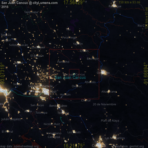
Analysis of San Juan Cancuc night lights 2016
Square area 10x10 km:
 0%
0%90-99
0%80-89
0.87%70-79
0%60-69
0.87%50-59
0.22%40-49
0.65%30-39
0%20-29
0%10-19
0%0-9
97.4%Square area 50x50 km:
0.01%90-99
0.17%80-89
0.21%70-79
0.28%60-69
0.33%50-59
0.49%40-49
0.88%30-39
0.91%20-29
0.94%10-19
2.12%0-9
93.67%Clear (daylight) street map image can be seen on geolist.org.
Map coordinates:
17° 33' 51.4" North, 93° 4' 23.5" West
16° 53' 33.8" North, 92° 22' 12.2" West
16° 13' 7.5" North, 91° 40' 1" West
Some cities around San Juan Cancuc sort by population:
• Ocosingo
29.4 km =18.3 mi,  87°
87°
• Chilón
25.8 km =16 mi,  23°
23°
• Chanal
28.8 km =17.9 mi,  155°
155°
• Pantelhó
16.6 km =10.3 mi,  319°
319°
• Oxchuc
12.2 km =7.6 mi,  167°
167°
• Altamirano
23.4 km =14.5 mi, 92°
• Chanal
19.8 km =12.3 mi,  189°
189°
• Bachajón
25.2 km =15.7 mi,  49°
49°
3816173 (p: 6,327)
Sources (retrieved 2019-11-25):
» Earth at Night: Flat Maps 2012, 2016