Altamirano night lights from space
Night Light of Altamirano (Chiapas) from space (Mexico) Src. Average luminocity for 10x10km area is 7.2381% and for 50x50km: 2.2256%.
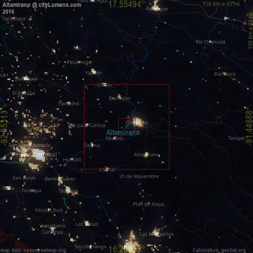
Analysis of Altamirano night lights 2016
Square area 10x10 km:
 0.22%
0.22%90-99
1.52%80-89
1.08%70-79
0.22%60-69
0%50-59
0.87%40-49
0.87%30-39
1.95%20-29
1.52%10-19
7.58%0-9
84.2%Square area 50x50 km:
0.16%90-99
0.3%80-89
0.43%70-79
0.27%60-69
0.16%50-59
0.31%40-49
0.4%30-39
0.42%20-29
0.47%10-19
1.2%0-9
95.89%Clear (daylight) street map image can be seen on geolist.org.
Map coordinates:
17° 33' 17.8" North, 92° 51' 11.3" West
16° 52' 60" North, 92° 9' 0" West
16° 12' 33.6" North, 91° 26' 48.8" West
Some cities around Altamirano sort by population:
• Ocosingo
6.5 km =4 mi,  66°
66°
• Chilón
28 km =17.4 mi,  332°
332°
• Chanal
27.6 km =17.1 mi,  204°
204°
• Pantelhó
36.8 km =22.9 mi,  291°
291°
• Oxchuc
23.4 km =14.5 mi,  242°
242°
• San Juan Cancuc
23.4 km =14.5 mi,  272°
272°
• Chanal
32.4 km =20.1 mi, 235°
• Bachajón
17.9 km =11.1 mi,  346°
346°
3532996 (p: 6,672)
Sources (retrieved 2019-11-25):
» Earth at Night: Flat Maps 2012, 2016