Chilón night lights from space
Night Light of Chilón (Chiapas) from space (Mexico) Src. Average luminocity for 10x10km area is 4.2489% and for 50x50km: 2.5636%.
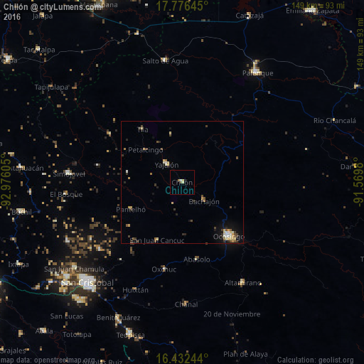
Analysis of Chilón night lights 2016
Square area 10x10 km:
 0%
0%90-99
0.87%80-89
1.52%70-79
0.22%60-69
0.87%50-59
0.87%40-49
0%30-39
0%20-29
0%10-19
0.87%0-9
94.81%Square area 50x50 km:
0.16%90-99
0.37%80-89
0.49%70-79
0.33%60-69
0.23%50-59
0.25%40-49
0.57%30-39
0.6%20-29
0.36%10-19
1.34%0-9
95.31%Clear (daylight) street map image can be seen on geolist.org.
Map coordinates:
17° 46' 35.2" North, 92° 58' 33.8" West
17° 6' 20.4" North, 92° 16' 22.5" West
16° 25' 56.8" North, 91° 34' 11.3" West
Some cities around Chilón sort by population:
• Ocosingo
29.2 km =18.1 mi,  139°
139°
• Yajalón
9.8 km =6.1 mi,  319°
319°
• Tila
27.2 km =16.9 mi, 322°
• Pantelhó
23.9 km =14.9 mi,  242°
242°
• Petalcingo
20.3 km =12.6 mi,  311°
311°
• Altamirano
28 km =17.4 mi,  152°
152°
• San Juan Cancuc
25.8 km =16 mi,  203°
203°
• Bachajón
11.5 km =7.1 mi,  129°
129°
3815701 (p: 7,368)
Sources (retrieved 2019-11-25):
» Earth at Night: Flat Maps 2012, 2016