Ocosingo night lights from space
Night Light of Ocosingo (Chiapas) from space (Mexico) Src. Average luminocity for 10x10km area is 29.5455% and for 50x50km: 2.1268%.
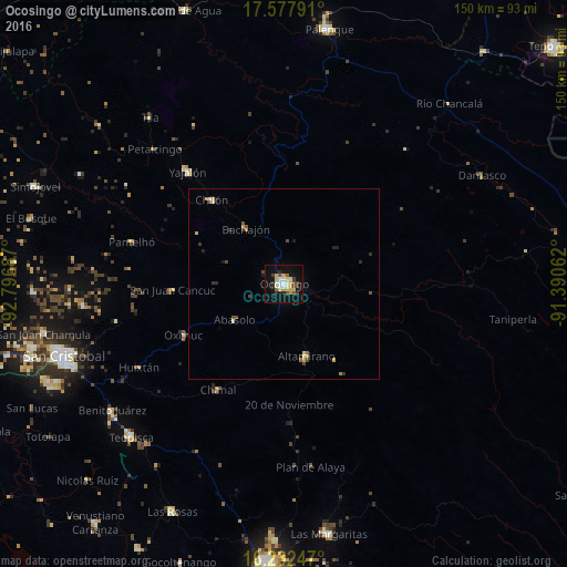

Analysis of Ocosingo night lights 2016
Square area 10x10 km:
 4.11%
4.11%90-99
5.84%80-89
5.84%70-79
4.11%60-69
0%50-59
2.6%40-49
3.68%30-39
5.63%20-29
2.81%10-19
27.71%0-9
37.66%Square area 50x50 km:
0.16%90-99
0.3%80-89
0.42%70-79
0.26%60-69
0.13%50-59
0.24%40-49
0.41%30-39
0.38%20-29
0.37%10-19
1.21%0-9
96.13%Clear (daylight) street map image can be seen on geolist.org.
Map coordinates:
17° 34' 40.5" North, 92° 47' 48.7" West
16° 54' 23" North, 92° 5' 37.5" West
16° 13' 56.9" North, 91° 23' 26.2" West
Some cities around Ocosingo sort by population:
• Altamirano
20 km =12.4 mi,  162°
162°
• Chilón
29.2 km =18.1 mi,  319°
319°
• Chanal
32.7 km =20.3 mi,  212°
212°
• Oxchuc
29.9 km =18.6 mi,  243°
243°
• Altamirano
6.5 km =4 mi,  246°
246°
• San Juan Cancuc
29.4 km =18.3 mi,  267°
267°
• Chanal
38.8 km =24.1 mi, 237°
• Bachajón
18 km =11.2 mi,  325°
325°
3522484 (p: 41,878)
Sources (retrieved 2019-11-25):
» Earth at Night: Flat Maps 2012, 2016