Oxchuc night lights from space
Night Light of Oxchuc (Chiapas) from space (Mexico) Src. Average luminocity for 10x10km area is 2.4675% and for 50x50km: 2.4478%.
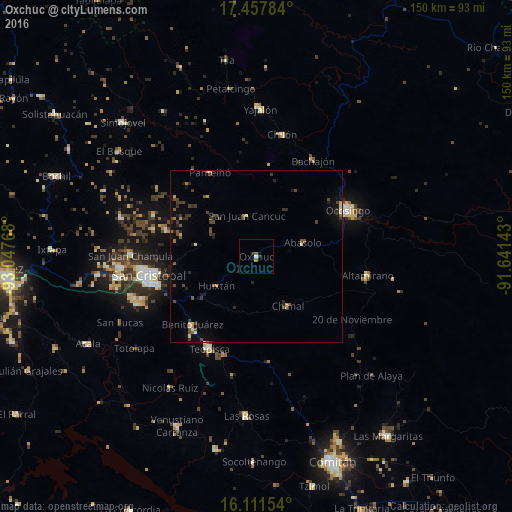
Analysis of Oxchuc night lights 2016
Square area 10x10 km:
 0%
0%90-99
0.87%80-89
0%70-79
0%60-69
0.65%50-59
1.08%40-49
0%30-39
0.65%20-29
1.08%10-19
0%0-9
95.67%Square area 50x50 km:
0%90-99
0.22%80-89
0.23%70-79
0.21%60-69
0.24%50-59
0.46%40-49
0.79%30-39
0.76%20-29
0.62%10-19
1.08%0-9
95.39%Clear (daylight) street map image can be seen on geolist.org.
Map coordinates:
17° 27' 28.2" North, 93° 2' 51.6" West
16° 47' 9.2" North, 92° 20' 40.4" West
16° 6' 41.5" North, 91° 38' 29.1" West
Some cities around Oxchuc sort by population:
• San Cristóbal de las Casas
32.2 km =20 mi,  259°
259°
• Ocosingo
29.9 km =18.6 mi,  63°
63°
• Teopisca
30.4 km =18.9 mi,  206°
206°
• Chanal
17 km =10.6 mi,  147°
147°
• Pantelhó
27.9 km =17.3 mi,  331°
331°
• Altamirano
23.4 km =14.5 mi, 62°
• San Juan Cancuc
12.2 km =7.6 mi,  347°
347°
• Chanal
9.7 km =6 mi,  217°
217°
3522256 (p: 6,675)
Sources (retrieved 2019-11-25):
» Earth at Night: Flat Maps 2012, 2016