Dolores Hidalgo Cuna de la Independencia Nacional night lights from space
Night Light of Dolores Hidalgo Cuna de la Independencia Nacional (Guanajuato) from space (Mexico) Src. Average luminocity for 10x10km area is 48.3532% and for 50x50km: 5.5346%.
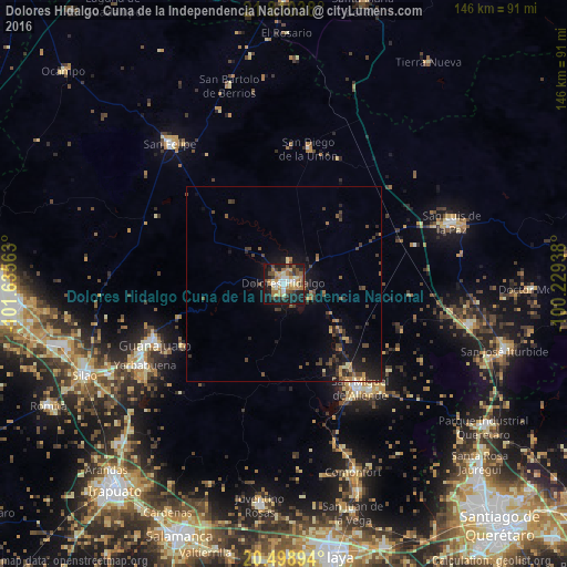
Analysis of Dolores Hidalgo Cuna de la Independencia Nacional night lights 2016
Square area 10x10 km:
 5.95%
5.95%90-99
6.94%80-89
7.14%70-79
9.13%60-69
11.9%50-59
5.56%40-49
7.14%30-39
6.35%20-29
11.51%10-19
26.98%0-9
1.39%Square area 50x50 km:
0.25%90-99
0.37%80-89
0.57%70-79
0.77%60-69
1.02%50-59
0.67%40-49
1.53%30-39
1.35%20-29
1.66%10-19
4.83%0-9
86.98%Clear (daylight) street map image can be seen on geolist.org.
Map coordinates:
21° 48' 37.4" North, 101° 38' 8.3" West
21° 9' 22" North, 100° 55' 57" West
20° 29' 56.2" North, 100° 13' 45.8" West
Some cities around Dolores Hidalgo Cuna de la Independencia Nacional sort by population:
• Guanajuato
37.2 km =23.1 mi,  245°
245°
• San Miguel de Allende
33.2 km =20.6 mi,  143°
143°
• San Luis de la Paz
45.8 km =28.5 mi,  69°
69°
• Marfil
40.8 km =25.4 mi,  243°
243°
• San Felipe
46.3 km =28.8 mi,  320°
320°
• Yerbabuena
41.5 km =25.8 mi, 238°
• San Diego de la Unión
35.2 km =21.9 mi,  10°
10°
• Santa Teresa
45.4 km =28.2 mi, 241°
4023117 (p: 59,240)
Sources (retrieved 2019-11-25):
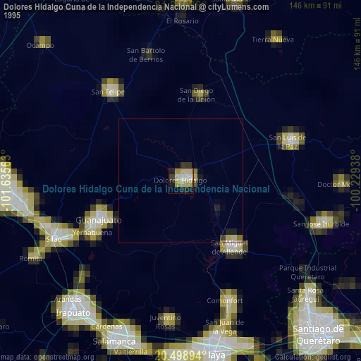
» NASA, Earths city lights 1995
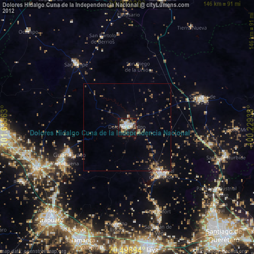
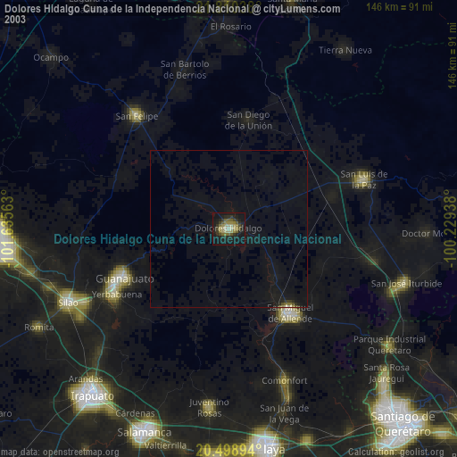
» NASA city lights 2003
» Earth at Night: Flat Maps 2012, 2016