San Cristóbal de las Casas night lights from space
Night Light of San Cristóbal de las Casas (Chiapas) from space (Mexico) Src. Average luminocity for 10x10km area is 58.1623% and for 50x50km: 12.0811%.
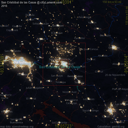
Analysis of San Cristóbal de las Casas night lights 2016
Square area 10x10 km:
 12.77%
90-99
22.51%80-89
5.63%70-79
2.16%60-69
1.08%50-59
2.16%40-49
7.79%30-39
14.07%20-29
25.32%10-19
6.49%0-9
0%Square area 50x50 km:
0.73%90-99
2.17%80-89
1.25%70-79
1.2%60-69
0.85%50-59
1.34%40-49
2.93%30-39
3.5%20-29
3.55%10-19
9.7%0-9
72.77%Clear (daylight) street map image can be seen on geolist.org.
Map coordinates:
17° 24' 14.1" North, 93° 20' 39.8" West
16° 43' 54.3" North, 92° 38' 28.5" West
16° 3' 26" North, 91° 56' 17.3" West
Some cities around San Cristóbal de las Casas sort by population:
• Teopisca
27.6 km =17.1 mi,  139°
139°
• Acala
26.1 km =16.2 mi,  221°
221°
• Pantelhó
35.4 km =22 mi,  30°
30°
• Oxchuc
32.2 km =20 mi,  79°
79°
• San Juan Cancuc
34 km =21.1 mi,  58°
58°
• Ixtapa
29.2 km =18.1 mi,  285°
285°
• Chanal
25.7 km =16 mi,  93°
93°
• El Bosque
37.8 km =23.5 mi,  346°
346°
3519537 (p: 158,027)
Sources (retrieved 2019-11-25):
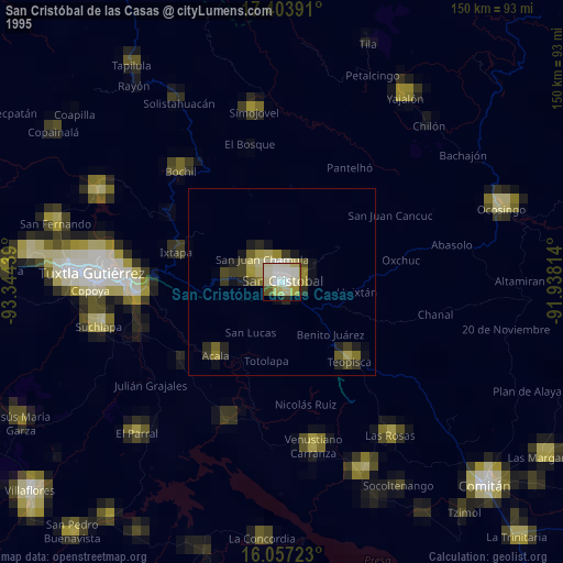
» NASA, Earths city lights 1995
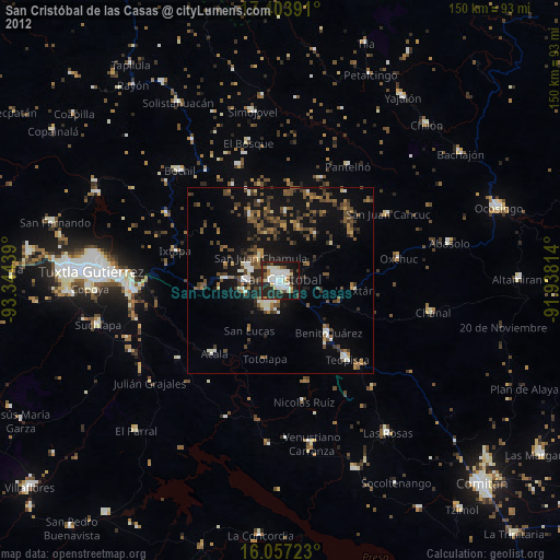
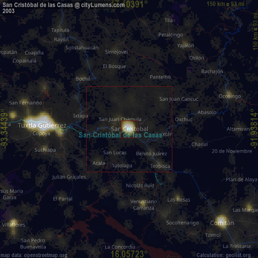
» NASA city lights 2003
» Earth at Night: Flat Maps 2012, 2016