Acala night lights from space
Night Light of Acala (Chiapas) from space (Mexico) Src. Average luminocity for 10x10km area is 5.0992% and for 50x50km: 10.2372%.
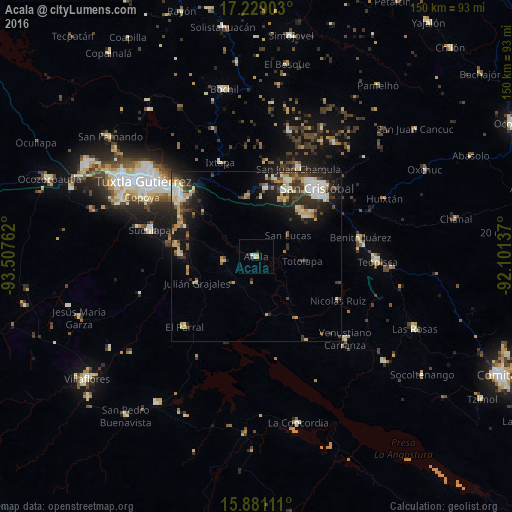
Analysis of Acala night lights 2016
Square area 10x10 km:
 0%
0%90-99
1.65%80-89
1.03%70-79
1.45%60-69
0%50-59
0%40-49
0%30-39
0.83%20-29
0.83%10-19
0.83%0-9
93.39%Square area 50x50 km:
0.88%90-99
2.27%80-89
1.57%70-79
1.23%60-69
0.9%50-59
0.77%40-49
1.8%30-39
2.39%20-29
3.08%10-19
6.04%0-9
79.07%Clear (daylight) street map image can be seen on geolist.org.
Map coordinates:
17° 13' 44.5" North, 93° 30' 27.4" West
16° 33' 22.5" North, 92° 48' 16.2" West
15° 52' 52" North, 92° 6' 4.9" West
Some cities around Acala sort by population:
• San Cristóbal de las Casas
26.1 km =16.2 mi,  41°
41°
• Chiapa de Corzo
27.8 km =17.3 mi,  307°
307°
• Suchiapa
32.5 km =20.2 mi,  283°
283°
• Teopisca
35.3 km =21.9 mi,  92°
92°
• Venustiano Carranza
35.4 km =22 mi,  133°
133°
• El Parral
29.8 km =18.5 mi,  226°
226°
• Copoya
37.9 km =23.5 mi,  297°
297°
• Ixtapa
29.5 km =18.3 mi,  338°
338°
3533483 (p: 13,889)
Sources (retrieved 2019-11-25):
» Earth at Night: Flat Maps 2012, 2016