Huilango night lights from space
Night Light of Huilango (México) from space (Mexico) Src. Average luminocity for 10x10km area is 85.0372% and for 50x50km: 59.5387%.
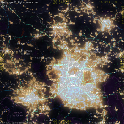
Analysis of Huilango night lights 2016
Square area 10x10 km:
 24.59%
90-99
27.69%80-89
18.39%70-79
14.88%60-69
4.34%50-59
2.69%40-49
3.51%30-39
1.86%20-29
2.07%10-19
0%0-9
0%Square area 50x50 km:
22.36%90-99
10.19%80-89
8.96%70-79
7.9%60-69
7.38%50-59
5.06%40-49
3.98%30-39
4.77%20-29
5.51%10-19
7.11%0-9
16.78%Clear (daylight) street map image can be seen on geolist.org.
Map coordinates:
20° 20' 28.4" North, 99° 57' 34.3" West
19° 40' 50" North, 99° 15' 23" West
19° 1' 1.7" North, 98° 33' 11.8" West
Some cities around Huilango sort by population:
• Cuautitlán Izcalli
5.9 km =3.7 mi,  133°
133°
• Nicolás Romero
6.8 km =4.2 mi,  230°
230°
• Cuautitlán
8.1 km =5 mi,  97°
97°
• Tepotzotlán
5.7 km =3.5 mi,  36°
36°
• Santiago Cuautlalpan
3.4 km =2.1 mi,  276°
276°
• San Mateo Xoloc
3 km =1.9 mi,  16°
16°
• Santa Cruz del Monte
10 km =6.2 mi, 16°
• San Mateo Ixtacalco
9.1 km =5.7 mi,  76°
76°
3827588 (p: 17,399)
Sources (retrieved 2019-11-25):
» Earth at Night: Flat Maps 2012, 2016