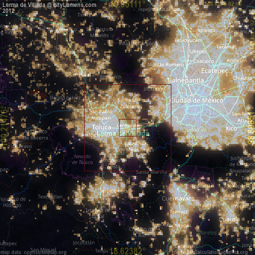
Lerma de Villada night lights from space
Night Light of Lerma de Villada (México) from space (Mexico) Src. Average luminocity for 10x10km area is 76.7727% and for 50x50km: 46.192%.
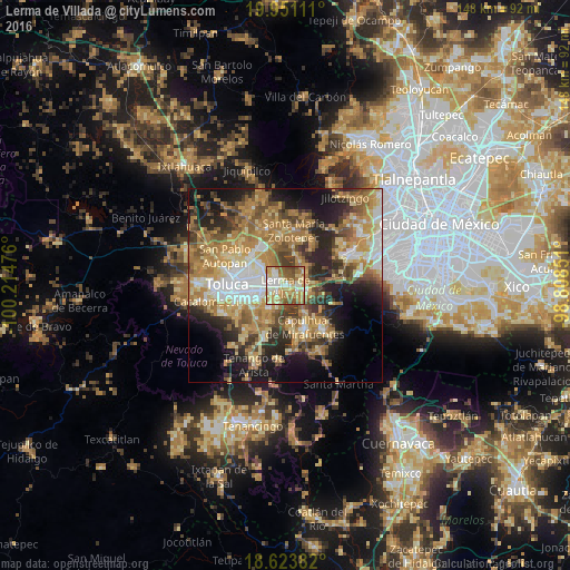
Analysis of Lerma de Villada night lights 2016
Square area 10x10 km:
 9.96%
9.96%90-99
18.4%80-89
17.1%70-79
18.18%60-69
18.18%50-59
12.77%40-49
4.98%30-39
0.43%20-29
0%10-19
0%0-9
0%Square area 50x50 km:
5.71%90-99
5.68%80-89
8.16%70-79
9.89%60-69
12.14%50-59
6.25%40-49
6.82%30-39
5.4%20-29
9.62%10-19
11.85%0-9
18.48%Clear (daylight) street map image can be seen on geolist.org.
Map coordinates:
19° 57' 4" North, 100° 12' 53.1" West
19° 17' 19.7" North, 99° 30' 41.9" West
18° 37' 25.8" North, 98° 48' 30.6" West
Some cities around Lerma de Villada sort by population:
• San Mateo Atenco
3.2 km =2 mi,  222°
222°
• Ocoyoacac
6 km =3.7 mi,  109°
109°
• San Pedro Tultepec
2.6 km =1.6 mi,  174°
174°
• San Pedro Cholula
3.8 km =2.4 mi,  135°
135°
• San Pedro Chochula
3.9 km =2.4 mi, 136°
• El Cerrillo Vista Hermosa
5 km =3.1 mi,  319°
319°
• Atizapán
5.9 km =3.7 mi, 223°
• San Miguel Ameyalco
5.9 km =3.7 mi,  70°
70°
3524389 (p: 22,713)
Sources (retrieved 2019-11-25):
» Earth at Night: Flat Maps 2012, 2016