Cuauhtémoc night lights from space
Night Light of Cuauhtémoc (Mexico City) from space (Mexico) Src. Average luminocity for 10x10km area is 100% and for 50x50km: 86.4228%.
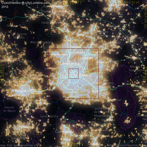
Analysis of Cuauhtémoc night lights 2016
Square area 10x10 km:
 100%
100%90-99
0%80-89
0%70-79
0%60-69
0%50-59
0%40-49
0%30-39
0%20-29
0%10-19
0%0-9
0%Square area 50x50 km:
47.59%90-99
16.07%80-89
11.41%70-79
9.15%60-69
5%50-59
2.44%40-49
1.99%30-39
1.48%20-29
1.85%10-19
1.49%0-9
1.53%Clear (daylight) street map image can be seen on geolist.org.
Map coordinates:
20° 6' 24.2" North, 99° 50' 57.3" West
19° 26' 42.2" North, 99° 8' 46" West
18° 46' 50.5" North, 98° 26' 34.8" West
Some cities around Cuauhtémoc sort by population:
• Mexico City
2.7 km =1.7 mi,  133°
133°
• Gustavo Adolfo Madero
6.6 km =4.1 mi,  34°
34°
• Venustiano Carranza
4.3 km =2.7 mi,  92°
92°
• Azcapotzalco
6.3 km =3.9 mi,  318°
318°
• Miguel Hidalgo
5.8 km =3.6 mi,  257°
257°
• Benito Juarez
5.3 km =3.3 mi,  193°
193°
• Colonia Lindavista
5.6 km =3.5 mi,  23°
23°
• Polanco
5.7 km =3.5 mi, 256°
3827409 (p: 531,831)
Sources (retrieved 2019-11-25):
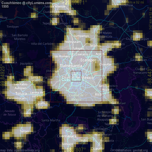
» NASA, Earths city lights 1995
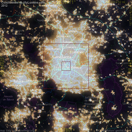
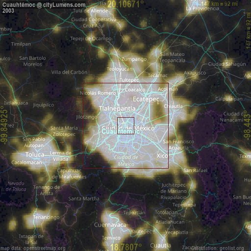
» NASA city lights 2003
» Earth at Night: Flat Maps 2012, 2016