Guadalupe Victoria night lights from space
Night Light of Guadalupe Victoria (Puebla) from space (Mexico) Src. Average luminocity for 10x10km area is 6.0649% and for 50x50km: 2.6159%.
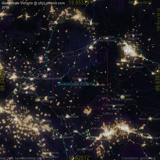
Analysis of Guadalupe Victoria night lights 2016
Square area 10x10 km:
 0.43%
0.43%90-99
0.43%80-89
2.6%70-79
0%60-69
0%50-59
0%40-49
1.52%30-39
2.16%20-29
1.52%10-19
0%0-9
91.34%Square area 50x50 km:
0.02%90-99
0.02%80-89
0.27%70-79
0.33%60-69
0.45%50-59
0.57%40-49
0.94%30-39
0.95%20-29
0.76%10-19
0.43%0-9
95.26%Clear (daylight) street map image can be seen on geolist.org.
Map coordinates:
19° 57' 12.2" North, 98° 2' 45.7" West
19° 17' 28" North, 97° 20' 34.4" West
18° 37' 34" North, 96° 38' 23.2" West
Some cities around Guadalupe Victoria sort by population:
• Perote
31.9 km =19.8 mi,  19°
19°
• Ciudad Serdán
35.4 km =22 mi,  197°
197°
• San Salvador El Seco
35.9 km =22.3 mi,  240°
240°
• Villa de El Carmen Tequexquitla
32.8 km =20.4 mi,  276°
276°
• Zacatepec
20.1 km =12.5 mi,  262°
262°
• Oriental
30.6 km =19 mi,  287°
287°
• Tlachichuca
21.2 km =13.2 mi, 202°
• Santa Maria Coatepec
33.1 km =20.6 mi,  232°
232°
3818786 (p: 10,035)
Sources (retrieved 2019-11-25):
» Earth at Night: Flat Maps 2012, 2016