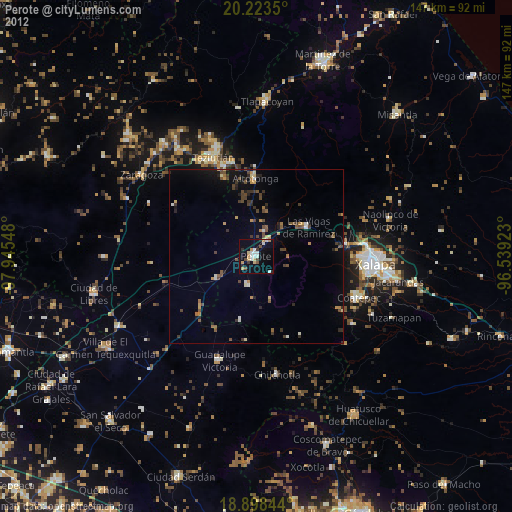
Perote night lights from space
Night Light of Perote (Veracruz) from space (Mexico) Src. Average luminocity for 10x10km area is 20.1653% and for 50x50km: 3.8462%.
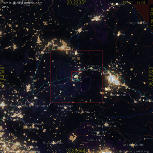
Analysis of Perote night lights 2016
Square area 10x10 km:
 1.03%
1.03%90-99
1.45%80-89
3.1%70-79
1.86%60-69
6.61%50-59
3.31%40-49
2.89%30-39
3.1%20-29
2.27%10-19
7.02%0-9
67.36%Square area 50x50 km:
0.06%90-99
0.12%80-89
0.51%70-79
0.28%60-69
0.69%50-59
0.53%40-49
1.03%30-39
1.1%20-29
1.03%10-19
2.55%0-9
92.09%Clear (daylight) street map image can be seen on geolist.org.
Map coordinates:
20° 13' 24.6" North, 97° 56' 43.7" West
19° 33' 44.4" North, 97° 14' 32.5" West
18° 53' 54.4" North, 96° 32' 21.2" West
Some cities around Perote sort by population:
• Teziutlan
30.9 km =19.2 mi,  336°
336°
• Coatepec
31.9 km =19.8 mi,  112°
112°
• Altotonga
22.7 km =14.1 mi,  359°
359°
• Xico
29.1 km =18.1 mi,  122°
122°
• Jalacingo
27.7 km =17.2 mi,  345°
345°
• Las Vigas de Ramírez
17.2 km =10.7 mi,  61°
61°
• San Juan Xiutetelco
27.4 km =17 mi, 341°
• Guadalupe Victoria
29.5 km =18.3 mi,  91°
91°
3521628 (p: 37,516)
Sources (retrieved 2019-11-25):
» Earth at Night: Flat Maps 2012, 2016