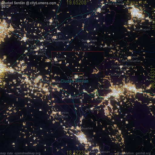
Ciudad Serdán night lights from space
Night Light of Ciudad Serdán (Puebla) from space (Mexico) Src. Average luminocity for 10x10km area is 11.4805% and for 50x50km: 7.9302%.
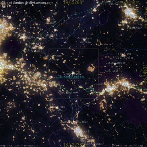
Analysis of Ciudad Serdán night lights 2016
Square area 10x10 km:
 0%
0%90-99
0.87%80-89
2.81%70-79
0.65%60-69
2.6%50-59
1.08%40-49
5.41%30-39
0.65%20-29
0.22%10-19
2.38%0-9
83.33%Square area 50x50 km:
0%90-99
0.19%80-89
0.8%70-79
1.36%60-69
2.3%50-59
1.24%40-49
1.92%30-39
1.53%20-29
1.2%10-19
5.21%0-9
84.26%Clear (daylight) street map image can be seen on geolist.org.
Map coordinates:
19° 39' 7.5" North, 98° 8' 58.4" West
18° 59' 18.8" North, 97° 26' 47.1" West
18° 19' 20.6" North, 96° 44' 35.9" West
Some cities around Ciudad Serdán sort by population:
• San Salvador El Seco
26.1 km =16.2 mi,  308°
308°
• Palmarito Tochapan
22.4 km =13.9 mi,  244°
244°
• Quecholac
22.6 km =14 mi,  260°
260°
• Xaltepec
20.8 km =12.9 mi, 235°
• Cuacnopalan
20.2 km =12.6 mi,  199°
199°
• Esperanza
16.2 km =10.1 mi,  153°
153°
• Tlachichuca
14.3 km =8.9 mi,  11°
11°
• Santa Maria Coatepec
20.4 km =12.7 mi, 311°
3530584 (p: 23,824)
Sources (retrieved 2019-11-25):
» Earth at Night: Flat Maps 2012, 2016