Marfil night lights from space
Night Light of Marfil (Guanajuato) from space (Mexico) Src. Average luminocity for 10x10km area is 57.9921% and for 50x50km: 17.7913%.
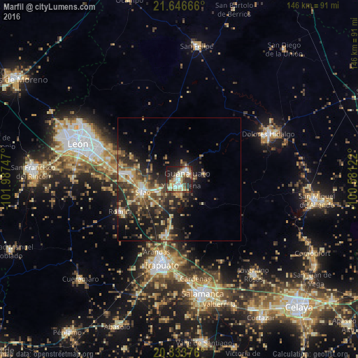
Analysis of Marfil night lights 2016
Square area 10x10 km:
 8.93%
8.93%90-99
16.27%80-89
8.73%70-79
9.52%60-69
6.94%50-59
4.37%40-49
6.55%30-39
6.75%20-29
22.82%10-19
8.93%0-9
0.2%Square area 50x50 km:
1.28%90-99
1.99%80-89
2.95%70-79
2.9%60-69
2.33%50-59
2.39%40-49
4.58%30-39
3.53%20-29
7.34%10-19
10.34%0-9
60.36%Clear (daylight) street map image can be seen on geolist.org.
Map coordinates:
21° 38' 48" North, 101° 59' 14.9" West
20° 59' 29.9" North, 101° 17' 3.6" West
20° 20' 1.5" North, 100° 34' 52.4" West
Some cities around Marfil sort by population:
• Silao
15.8 km =9.8 mi,  250°
250°
• Guanajuato
4 km =2.5 mi,  41°
41°
• Romita
27.6 km =17.1 mi,  240°
240°
• Yerbabuena
3.3 km =2.1 mi,  162°
162°
• Arandas
31.1 km =19.3 mi,  197°
197°
• Santa Teresa
4.9 km =3 mi,  223°
223°
• Duarte
27.1 km =16.8 mi,  293°
293°
• La Aldea
22.5 km =14 mi, 243°
3996595 (p: 29,375)
Sources (retrieved 2019-11-25):
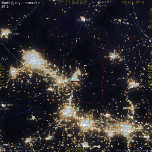
» Earth at Night: Flat Maps 2012, 2016