San Miguel de Allende night lights from space
Night Light of San Miguel de Allende (Guanajuato) from space (Mexico) Src. Average luminocity for 10x10km area is 54.5079% and for 50x50km: 11.1203%.
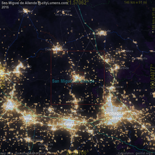
Analysis of San Miguel de Allende night lights 2016
Square area 10x10 km:
 4.76%
4.76%90-99
6.35%80-89
14.68%70-79
12.7%60-69
9.52%50-59
2.98%40-49
11.71%30-39
8.13%20-29
19.05%10-19
10.12%0-9
0%Square area 50x50 km:
0.27%90-99
0.41%80-89
1.72%70-79
2.04%60-69
1.47%50-59
1.18%40-49
2.71%30-39
2.89%20-29
3.09%10-19
10.26%0-9
73.96%Clear (daylight) street map image can be seen on geolist.org.
Map coordinates:
21° 34' 14.2" North, 101° 26' 49.3" West
20° 54' 55" North, 100° 44' 38" West
20° 15' 25.4" North, 100° 2' 26.8" West
Some cities around San Miguel de Allende sort by population:
• Dolores Hidalgo Cuna de la Independencia Nacional
33.2 km =20.6 mi,  323°
323°
• Juventino Rosas
39.8 km =24.7 mi,  220°
220°
• Comonfort
21.5 km =13.4 mi,  184°
184°
• San José Iturbide
38.6 km =24 mi,  75°
75°
• Santa Rosa Jauregui
36.3 km =22.6 mi,  122°
122°
• Empalme Escobedo
27 km =16.8 mi, 180°
• Juriquilla
37.5 km =23.3 mi,  126°
126°
• San Juan de la Vega
32.3 km =20.1 mi, 183°
3985344 (p: 69,811)
Sources (retrieved 2019-11-25):
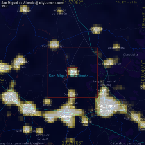
» NASA, Earths city lights 1995
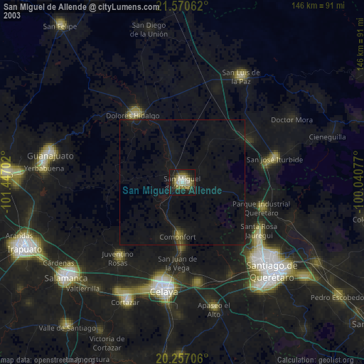
» NASA city lights 2003
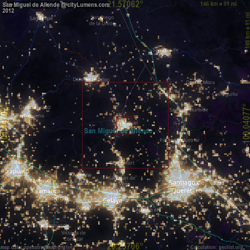
» Earth at Night: Flat Maps 2012, 2016