Degollado night lights from space
Night Light of Degollado (Jalisco) from space (Mexico) Src. Average luminocity for 10x10km area is 10.8182% and for 50x50km: 8.7474%.
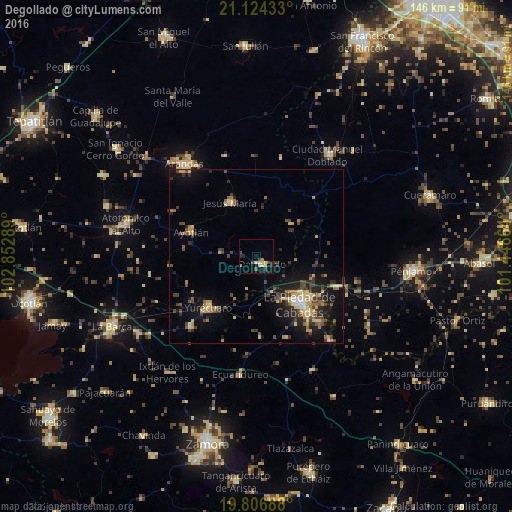
Analysis of Degollado night lights 2016
Square area 10x10 km:
 0%
0%90-99
0.95%80-89
3.6%70-79
1.14%60-69
1.14%50-59
0%40-49
4.36%30-39
0.57%20-29
3.79%10-19
0.76%0-9
83.71%Square area 50x50 km:
0.2%90-99
0.62%80-89
1.7%70-79
1.25%60-69
1.28%50-59
0.73%40-49
2.39%30-39
1.76%20-29
2.43%10-19
5.68%0-9
81.94%Clear (daylight) street map image can be seen on geolist.org.
Map coordinates:
21° 7' 27.6" North, 102° 51' 10.4" West
20° 28' 1.3" North, 102° 8' 59.1" West
19° 48' 24.8" North, 101° 26' 47.9" West
Some cities around Degollado sort by population:
• La Piedad
18.6 km =11.6 mi,  138°
138°
• Arandas
33.5 km =20.8 mi,  322°
322°
• Yurécuaro
20.2 km =12.6 mi,  223°
223°
• Ayotlán
19.6 km =12.2 mi,  290°
290°
• Santa Ana Pacueco
19.3 km =12 mi,  133°
133°
• Tanhuato de Guerrero
27.7 km =17.2 mi, 223°
• Jesús María
17.2 km =10.7 mi,  333°
333°
• La Ribera
19.1 km =11.9 mi,  226°
226°
4012045 (p: 10,753)
Sources (retrieved 2019-11-25):
» Earth at Night: Flat Maps 2012, 2016