Ciudad Nezahualcoyotl night lights from space
Night Light of Ciudad Nezahualcoyotl (México) from space (Mexico) Src. Average luminocity for 10x10km area is 98.2231% and for 50x50km: 84.6393%.
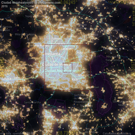
Analysis of Ciudad Nezahualcoyotl night lights 2016
Square area 10x10 km:
 76.65%
90-99
14.67%80-89
8.06%70-79
0.62%60-69
0%50-59
0%40-49
0%30-39
0%20-29
0%10-19
0%0-9
0%Square area 50x50 km:
42.28%90-99
15.33%80-89
12.73%70-79
10.75%60-69
6.32%50-59
2.95%40-49
3.13%30-39
2.03%20-29
2.35%10-19
1.68%0-9
0.45%Clear (daylight) street map image can be seen on geolist.org.
Map coordinates:
20° 3' 44.8" North, 99° 43' 4.7" West
19° 24' 2.2" North, 99° 0' 53.4" West
18° 44' 9.9" North, 98° 18' 42.2" West
Some cities around Ciudad Nezahualcoyotl sort by population:
• Iztapalapa
7.1 km =4.4 mi,  224°
224°
• Santa María Chimalhuacán
7.1 km =4.4 mi,  70°
70°
• Los Reyes Acaquilpan
5.7 km =3.5 mi,  136°
136°
• Magdalena Atlicpac
7.7 km =4.8 mi,  117°
117°
• Emiliano Zapata
7.6 km =4.7 mi,  146°
146°
• San Sebastián Chimalpa
6.6 km =4.1 mi,  108°
108°
• Tecamachalco
7.4 km =4.6 mi,  127°
127°
• Arenal
7.9 km =4.9 mi, 106°
3530589 (p: 1,104,585)
Sources (retrieved 2019-11-25):
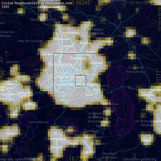
» NASA, Earths city lights 1995
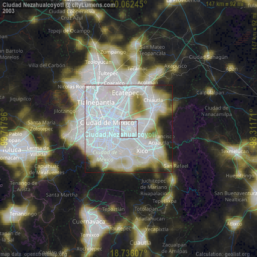
» NASA city lights 2003
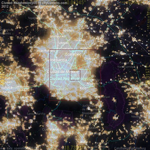
» Earth at Night: Flat Maps 2012, 2016