Santa María Chimalhuacán night lights from space
Night Light of Santa María Chimalhuacán (México) from space (Mexico) Src. Average luminocity for 10x10km area is 94.3678% and for 50x50km: 76.275%.
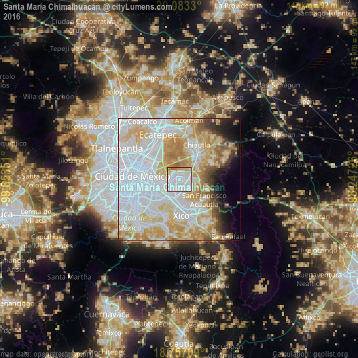
Analysis of Santa María Chimalhuacán night lights 2016
Square area 10x10 km:
 52.69%
90-99
27.48%80-89
6.82%70-79
7.85%60-69
2.48%50-59
2.69%40-49
0%30-39
0%20-29
0%10-19
0%0-9
0%Square area 50x50 km:
35.04%90-99
13.91%80-89
12.57%70-79
10.92%60-69
5.99%50-59
3.06%40-49
2.66%30-39
2.11%20-29
2.75%10-19
4.14%0-9
6.85%Clear (daylight) street map image can be seen on geolist.org.
Map coordinates:
20° 4' 59.9" North, 99° 39' 12.6" West
19° 25' 17.6" North, 98° 57' 1.4" West
18° 45' 25.5" North, 98° 14' 50.1" West
Some cities around Santa María Chimalhuacán sort by population:
• Chicoloapan
5.1 km =3.2 mi,  95°
95°
• Magdalena Atlicpac
5.8 km =3.6 mi,  178°
178°
• San Sebastián Chimalpa
4.5 km =2.8 mi,  186°
186°
• Lomas de San Sebastián
4.7 km =2.9 mi,  157°
157°
• Santiago Cuautlalpan
5.3 km =3.3 mi,  76°
76°
• Profesor Carlos Hank González
5.6 km =3.5 mi,  167°
167°
• Montecillo
5.9 km =3.7 mi,  48°
48°
• Arenal
4.6 km =2.9 mi, 169°
3517270 (p: 612,383)
Sources (retrieved 2019-11-25):
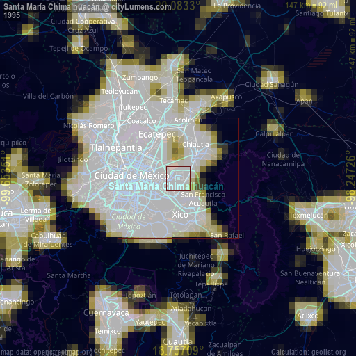
» NASA, Earths city lights 1995
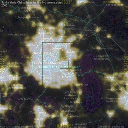
» NASA city lights 2003
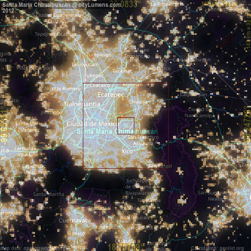
» Earth at Night: Flat Maps 2012, 2016